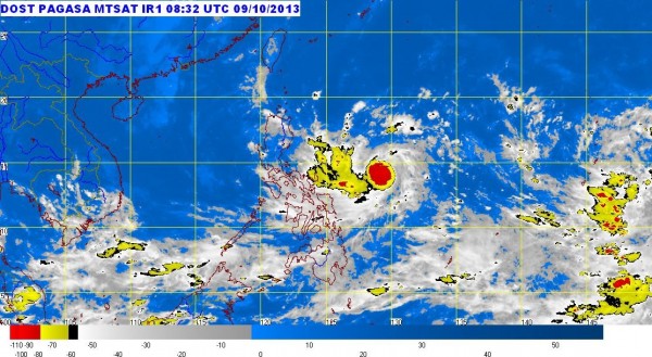
MANILA, Philippines – Tropical depression “Santi” was forecast to make landfall in Aurora on Saturday, the state weather bureau said on Wednesday afternoon.
The cyclone was last observed 510 kilometers east of Virac in Catanduanes, with maximum sustained winds of 55 kilometers per hour, the Philippine Atmospheric, Geophysical and Astronomical Services Administration said.
Joey Figuracion of Pagasa told INQUIRER.net that “Santi” could intensify into a storm.
A new low pressure area was also spotted over Pacific Ocean. It also may intensify into a cyclone within 24 hours. If it would enter the Philippine area of responsibility (PAR), it will be named “Tino.”
It will only stay briefly in PAR, however, Figuracion said.
“Calabarzon, Bicol Region, Visayas, Mindanao and the provinces of Mindoro, Marinduque and Romblon will have cloudy skies with light to moderate rainshowers and thunderstorms,” Pagasa said in its afternoon bulletin.
Metro Manila and the rest of the country will be partly cloudy to cloudy with isolated rainshowers or thunderstorms mostly in the afternoon or evening.
Light to moderate winds coming from the north to northwest will prevail over Luzon and blowing from the northwest to southwest over the rest of the country. The coastal waters over the entire archipelago will be slight to moderate.
