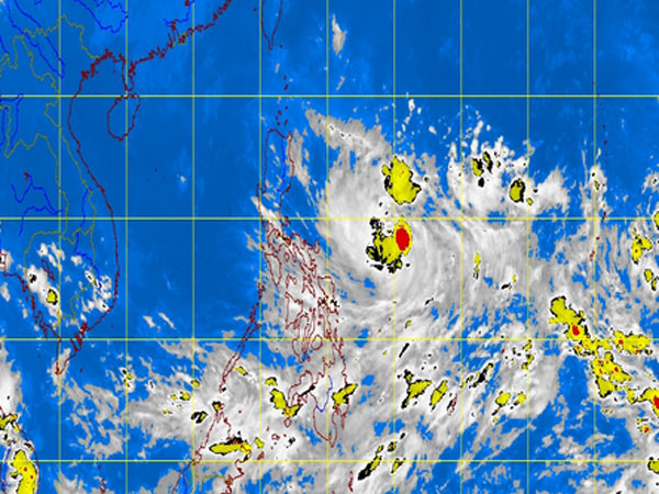
MT Satellite image October 9, 2013, Wednesday, 10:32 AM. Screengrab from https://www.pagasa.dost.gov.ph/
MANILA, Philippines—The low pressure area east of Virac, Catanduanes intensified into a tropical depression Tuesday night and was named “Santi,” the state weather bureau said Wednesday.
Santi was last spotted 600 kilometers east of Virac, Catanduanes packing maximum sustained winds of 45 kilometers per hour, the Philippine Atmospheric Geophysical and Astronomical Services Administration said.
The cyclone was forecast to move west northwest at 15 kph.
Mimaropa, Bicol Region, Visayas and Mindanao will have cloudy skies with light to moderate rainshowers and thunderstorms, Pagasa said.
Metro Manila and the rest of Luzon will be partly cloudy to cloudy with isolated rainshowers or thunderstorms mostly in the afternoon or evening.