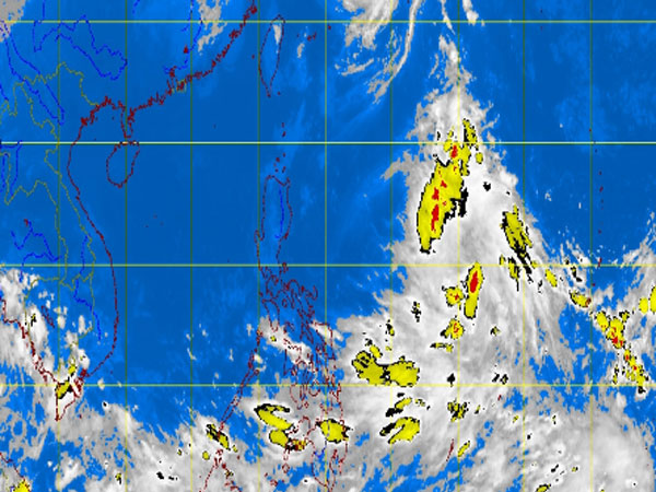
MT Satellite image October 8, 2013, Tuesday, 9:32AM. Screengrab from https://www.pagasa.dost.gov.ph/
MANILA, Philippines—A new low pressure area was spotted east of Catanduanes over the Pacific Ocean early Tuesday, the state weather bureau said.
The LPA was last observed 1,000 kilometers east of Virac, Catanduanes, the Philippine Atmospheric Geophysical and Astronomical Services Administration said.
Should it intensify into a cyclone, it would be called “Santi.”
An intertropical convergence zone was affecting Visayas and Mindanao and will bring cloudy skies with light to moderate rains and thunderstorms.
Metro Manila and the rest of the country will be partly cloudy to cloudy with isolated rainshowers or thunderstorms mostly in the afternoon or evening, Pagasa said.
Light to moderate winds coming from the northwest to southwest will prevail over the entire archipelago and the coastal waters will be slight to moderate, it added.