‘Quedan’ slows down, rain in Metro Manila, parts of PH—Pagasa

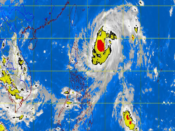
MT Satellite image October 3, 2013, Thursday, 9:32AM. Screengrab from https://www.pagasa.dost.gov.ph/
MANILA, Philippines —Tropical storm Quedan (international name Fitow) slowed down as it hovered extreme Northern Luzon, the state weather bureau said Thursday.
The storm was last observed 700 kilometers east of Basco, Batanes with maximum sustained winds of 105 kilometers per hour near the center and gusts of up to 35 kph, the Philippine Atmospheric Geophysical and Astronomical Services Administration said.
It is forecast to move north northwest at 11 kph.
“Western Visayas and the provinces of Cagayan, Zambales, Bataan and northern Palawan will have cloudy skies with light to moderate rainshowers and thunderstorms,” Pagasa said.
The rest of the country, including Metro Manila, will be partly cloudy to cloudy with isolated rainshowers or thunderstorms.
Article continues after this advertisementLight to moderate winds coming from the northwest will prevail over the rest of Luzon as well as the southwest to west over the rest of the country.