Quedan continues north, to exit PH by Friday—Pagasa

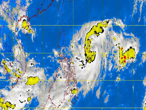
MT Satellite image October 2, 2013, Wednesday, 8:32AM. Screengrab from https://www.pagasa.dost.gov.ph/
MANILA, Philippines — Tropical storm Quedan (international name Fitow) accelerated north on Wednesday morning as it continued to hover over Tuguegarao City, the state weather bureau said.
The storm packed maximum sustained winds of 85 kilometers per hour near the center and gusts of up to 100 kph, the Philippine Atmospheric Geophysical and Astronomical Services Administration said.
Quedan was last located 880 kilometers east of Tuguegarao City and was moving at 17 kilometers per hour.
Quedan is expected to exit the Philippine area of responsibility by Friday evening.
“Quezon Province, Bicol Region, Visayas and Mindanao will have cloudy skies with light to moderate rainshowers and thunderstorms,” Pagasa said.
Article continues after this advertisementThe rest of Luzon, including Metro Manila, will be partly cloudy to cloudy with isolated rainshowers or thunderstorms.
Article continues after this advertisementModerate to occasionally strong winds from the west to southwest will prevail over the eastern section of Visayas and of Mindanao.The coastal waters along these areas will be moderate to occasionally rough, Pagasa said.
Light to moderate winds coming from the northeast to northwest will prevail over Luzon while there will be slight to moderate seas over the southwest to west and the rest of the country.