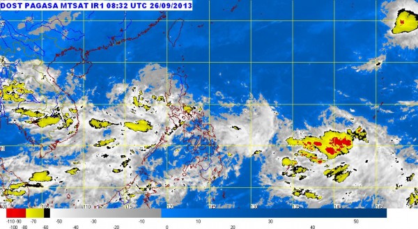
MTSAT ENHANCED-IR Satellite Image as of 4:32 p.m., September 26, 2013 https://www.pagasa.dost.gov.ph/
MANILA, Philippines — The low pressure area being monitored by the state weather bureau intensified into a tropical depression Thursday afternoon and was locally named “Paolo.”
The cyclone was last spotted 230 kilometers west of Subic, Zambales, and is forecast to exit the Philippine area of responsibility by Saturday afternoon, the Philippine Atmospheric Geophysical and Astronomical Services Administration said.
Paolo packed maximum sustained winds of 45 kilometers per hour near the center and was moving slowly west at 7 kph.
Moderate to occasionally heavy rains were seen within the 300 kilometer-diameter of Paolo.
It has not so far directly affected any part of the country but it will enhance the southwest monsoon. Moderate to occasionally heavy rains and thunderstorms were forecast over Zambales, Bataan, Mindoro and northern Palawan.