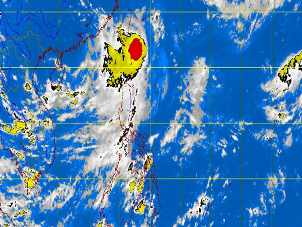
MT Satellite image August 29, 2013, Thursday, 7:00AM. Screengrab from https://www.pagasa.dost.gov.ph/.
MANILA, Philippines—All storm signals were lifted as tropical storm Nando (international name Kong-Rey) moved away from the country, while a new low pressure area was spotted off extreme Northern Luzon, the state weather bureau said Thursday.
The storm gained strength, with maximum sustained winds of 105 kilometers per hour and gusts of up to 135 kph, said the Philippine Atmospheric Geophysical and Astronomical Services Administration (Pagasa).
It also accelerated and was already moving at 19 kph. It is expected to exit Thursday afternoon.
Nando was last observed 310 kilometers north northeast of Basco, Batanes, and is still expected to bring heavy to intense rains within its 500 kilometer-diameter.
It will continue to enhance the southwest monsoon which will bring moderate to heavy rains and thunderstorms over Calayan, Babuyan and Batanes group of Islands, which may trigger possible flash floods and landslides. Light to moderate rain showers and thunderstorms over the rest of Northern Luzon were also seen.
Pagasa warned that sea travel is still risky over the seaboards of Northern Luzon.
The low pressure area, meanwhile, was last spotted 1,300 kilometers east of extreme Northern Luzon.