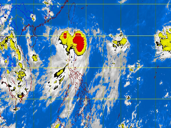
MT Satellite image August 28, 2013, Wednesday, 11:32 AM. Screengrab from https://www.pagasa.dost.gov.ph/.
MANILA, Philippines — Tropical storm Nando (international name Kong-Rey) slightly intensified but slowed down as it continued to hover over extreme Northern Luzon, the state weather bureau said midday Wednesday.
Storm Signal No. 2 remained up over the Batanes Group of Islands, while Signal No. 1 was still up in Calayan and Babuyan Group of Islands, the Philippine Atmospheric Geophysical and Astronomical Services Administration said.
Nando packed maximum sustained winds of 95 kilometers per hour near the center and gusts of up to 120 kph.
It was moving north at 15 kph.
Heavy to intense rains were seen within its 500 kilometer-diameter, and would continue to enhance the southwest monsoon which would bring light to moderate with at times heavy rains and thunderstorms over Metro Manila and the rest of Luzon.
Sea travel is risky over seaboards of Northern Luzon, Pagasa said.
Related Stories:
Tropical storm ‘Nando’ continues to move away from PH; to exit PAR Thursday
Tropical storm ‘Nando’ claims 1 fatality in Samar