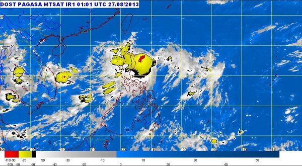
MANILA, Philippines — Tropical storm “Nando” (international name Kong-Rey) maintained its strength as it moved towards Batanes Tuesday afternoon, the state weather bureau said.
It will continue to bring heavy to intense rains within its 400 kilometer diameter, the Philippine Atmospheric Geophysical and Astronomical Administration said.
Nando was last observed 220 kilometers northeast of Aparri, Cagayan.
Signal No.2 remained hoisted over Batanes Group of Islands, while Signal No. 1 was up in Cagayan, Calayan, Babuyan Group of Islands, Apayao and Isabela, Pagasa said.
The storm packed sustained winds of 75 kilometers per hour near the center and gusts of up to 90 kph. It continued to move north northwest at 15 kph.
Residents of areas under storm signals as well as those living in the Ilocos Region, Zambales and Bataan were warned by Pagasa against possible flashfloods and landslides.
Those living in coastal areas under storm Signal No. 2 were alerted against storm surges.
It will also continue to enhance the southwest monsoon which will bring light to moderate with at times heavy rains and thunderstorms over Metro Manila and the rest of Luzon.
Sea travel is risky over the western and eastern seaboards of Luzon.
