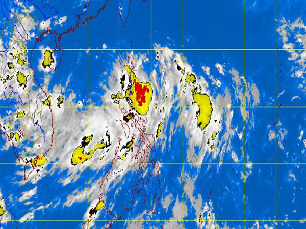
MT Satellite image August 27, 2013, Tuesday, 11:32 AM. Screengrab from https://www.pagasa.dost.gov.ph/.
MANILA, Philippines — Tropical storm Nando (international name Kong-Rey) maintained its strength as it continued to threaten extreme Northern Luzon, the state weather bureau said.
Storm Signal No. 2 remained up in Batanes Group of Islands, the Philippine Atmospheric Geophysical and Astronomical Services Administration.
Signal No. 1 is still up in Cagayan, Calayan, Babuyan Group of Islands, Apayao and Isabela.
Nando will bring moderate to heavy rains over the provinces of Ilocos Norte and Ilocos Sur.
Nando was last spotted 210 kilometers east of Aparri, Cagayan, Pagasa said.
The storm packed maximum sustained winds of 75 kilometers per hour near the center and gusts of up to 90 kph. It continued to move north northwest at 15 kph.
It will also continue to enhance the southwest monsoon which will bring light to moderate with at times heavy rains and thunderstorms over Metro Manila and the rest of Luzon.
Heavy to intense rains were seen within its 400 kilometer-diameter.
Sea travel is risky over the eastern seaboard of Central and Southern Luzon.
Related Story:
Tropical storm ‘Nando’ gains strength; Batanes now under Signal No. 2