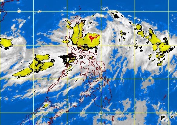
‘Nando’ now a tropical storm, more Luzon areas under Signal No. 1
MANILA, Philippines – More areas in Luzon were placed under Signal No. 1 as “Nando” (international name Kong-Rey), the 14th cyclone in the Philippines for 2013, intensified into a tropical storm, the state weather bureau said Monday afternoon.
The Philippine Atmospheric Geophysical and Astronomical Services Administration said Signal No. 1 (45 to 60 kph winds) was hoisted in the following areas:
-Batanes Group of islands
-Cagayan including Calayan and Babuyan Group of Islands
-Apayao
Article continues after this advertisement-Isabela
Article continues after this advertisementNando was now packing maximum sustained winds 65 kilometers per hour and gusts of up to 80 kph.
The storm was last observed 270 kilometers east of Casiguran, Aurora. It is forecast to move northwest at 15 kph, Pagasa said.
It is expected to exit by Thursday if it maintains its speed.
Based on forecast models, Nando made no indications of making landfall, Pagasa said.
Heavy to intense rains are seen within its 400 kilometer-diameter, and it will enhance the southwest monsoon.
Light to occasionally heavy rains and thunderstorms are forecast in Metro Manila and the rest of Southern Luzon.
Sea travel is still risky over the eastern seaboard of Central and Southern Luzon.
