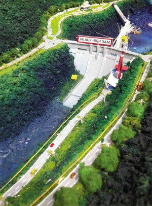
Dam project can withstand strong quake–NIA
ILOILO CITY—The controversial P11.2-billion multipurpose dam project in Iloilo can withstand an intensity 9 earthquake and is being supported by most of the affected residents, proponents of the project claimed.
Dismissing protests and warnings raised by opponents of the project, officials and experts of the National Irrigation Administration (NIA) assured the public of the safety of the Jalaur River Multipurpose Project II (JRMP II).
The JRMP II is the second of a two-stage project aimed at the multipurpose use of water of the Jalaur River, one of the major rivers of Panay Island.
The project was implemented after the passing of Republic Act No. 2651 in 1960.
It aims to develop irrigation systems, generate hydroelectric power and provide domestic and industrial water supply. The first phase was implemented from 1977 to 1983.
The second phase involves the construction of three dams (Jalaur reservoir, afterbay and catch dams), a 6.6-megawatt hydro power plant and an
81-kilometer highline canal.
The Iloilo-based People’s Movement for Jalaur River (PMJR) earlier raised warnings on the safety of the project and its environmental impact.
The group, composed of people’s organizations, church groups, indigenous communities, environmental advocates and scientists, also accused the government of ignoring protests of residents opposing the project.
The PMJR said the dam could worsen and not mitigate flooding and could pose danger because of its proximity to the active West Panay fault line.
But Jesus Datoon, assistant project manager, said the dam to be built in Calinog town in Iloilo could withstand a strong earthquake.
“There is no danger and there is nothing to be afraid of,” Datoon said in a briefing.
He also belied preliminary assessments of Samahan ng Nagtataguyod ng Agham at Teknolohiya Para sa Sambayanan that there were geologic “joints” or fractures and movements in rock formations in the area, which the group said could indicate weaknesses in the proposed dam’s foundation.
“The joints and cracks on rocks were superficial. Drillings conducted by our geologists as deep as 100 meters below the surface showed that the dam would be built on solid rock foundation,” Datoon said.
NIA project consultant Ruben Atienza said there was also no risk of overflowing and massive flooding in low-lying areas.
He said the dam was designed to gradually release water for hydropower generation, irrigation and potable water.
“The dam has the capacity to store 223 million cubic meters or equivalent to 280 million drums of water before it overflows,” Atienza said.
Mayor Alex Centena of Calinog said his town was supporting the project because it “provides us a chance to uplift our town economically.”
“We won’t gamble our lives if we know that the project is dangerous,” Centena said in the briefing.
Several village chiefs and tribal leaders of Tumandok communities who will be affected by the project also attended the briefing to express their support for the JRMP II.
“The project will provide an opportunity for our children to be educated because schools will also be put up,” said Tumandok tribal leader Avelino Caras.
Barangay (village) Chair Jimmy Caballero of Agcalaga said protests against the project “does not reflect the sentiments of most of our residents.”
NIA officials said a survey conducted by the agency among residents of 10 affected villages showed that 88.9 percent supported the project,
8.2 percent had doubts and
3 percent were against.
Alfonso Catolin, regional director of the National Commission on Indigenous Peoples (NCIP), said that in the free and prior informed consent (FPIC) survey for the conduct of a feasibility study, two of 10 target barangays opposed the conduct of the study.
Under the Indigenous Peoples’ Rights Act (RA 8371), proponents of projects and activities that will affect indigenous peoples’ (IP) communities are required to apply for an FPIC and secure a certification from the NCIP that the project is supported by the affected IP communities.
Catolin said a separate FPIC was required for the construction stage of the project.
The project will affect nine barangays directly and seven others indirectly. The villages that will be affected directly involve 581 families or 2,905 persons, 1,743 hectares of farm lands, and 489 lots covered by a certificate of ancestral domain title, according to rough estimates of the NIA.
Families that will be dislocated will be provided relocation, compensation, livelihood support programs among others, according to agency.
