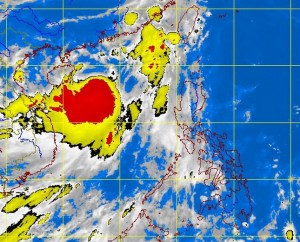
MANILA, Philippines – A new low pressure area was spotted off east of Mindanao while a weak southwest monsoon was affecting the western section of Luzon, the state weather bureau said on Friday.
The LPA was spotted 1,340 kilometers east of southern Mindanao and embedded along an intertropical convergence zone, the Philippine Atmospheric Geophysical and Astronomical Services Administration said.
Should it intensify into a cyclone, it will be locally named “Kiko”.
Weather forecaster Fernando Cada earlier told INQUIRER.net that up to four tropical cyclones were forecast to hit the country this month.
“Mimaropa and Western Visayas will experience cloudy skies with light to moderate rainshowers and thunderstorms,” Pagasa said in its weather bulletin.
Meanwhile, Metro Manila and the rest of the country will be partly cloudy to cloudy with isolated rainshowers or thunderstorms.
Moderate to strong winds blowing from the southwest to south will prevail over the western section of Luzon and its coastal waters will be moderate to rough. Elsewhere, winds will be light to moderate coming from the southeast to south with slight to moderate seas, Pagasa also said.
