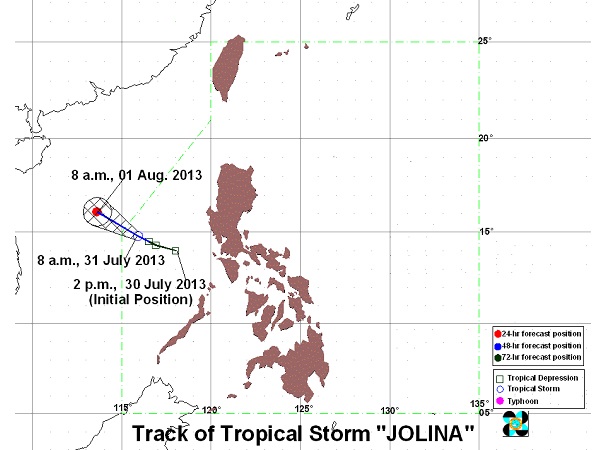
MANILA, Philippines—While on its way out of the Philippine territory, “Jolina” intensified into a tropical storm as a new low pressure area was spotted off Catanduanes midday Wednesday.
Jolina was packing maximum sustained winds of 65 kilometers per hour near the centers and gusts of up to 80 kph, the Philippine Atmospheric Geophysical and Astronomical Services Administration said.
The storm, last spotted at 450 km west of Subic, Zambales, continued to move northwest at 11 kph. It is forecast to exit by Wednesday evening, where it is forecast to be 660 kilometers west of Subic.
Jolina will bring moderate to heavy rains within its 300 km diameter.
It will also enhance the southwest monsoon and will bring moderate to heavy rains over Mimaropa and Calabarzon regions.
Meanwhile, the low pressure area was last observed 210 kilometers east of Virac in Catanduanes. If it intensifies into a tropical depression, it will be called “Kiko.”
