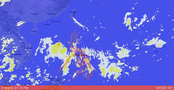
MANILA, Philippines – A new low-pressure area has been spotted in the West Philippine Sea but the state weather bureau sees only a slim chance of it developing into a storm within the country’s area of responsibility.
As of Thursday morning, the LPA was located 170 kilometers west of Calapan City, Oriental Mindoro, the Philippine Atmospheric, Geophysical and Astronomical Services Administration (Pagasa) said.
The weather disturbance was embedded in the Intertropical Convergence Zone affecting southern Luzon and the Visayas, bringing rains to those areas.
Pagasa forecaster Jori Loiz said the LPA had only a small chance of turning into a tropical cyclone while in Philippine territory.
“Based on our projection, it may already exit by afternoon today (Thursday),” he said.
Loiz said Pagasa was also watching a cluster of clouds east of Mindanao that might form an LPA but it was too early to say if it would.
Based on Pagasa’s weather outlook for Friday, Metro Manila and the rest of Luzon will have cloudy skies with light to moderate rain showers and thunderstorms.
The rest of the country will be partly cloudy to cloudy with isolated rain showers or thunderstorms mostly in the afternoon or evening, it added.
Light to moderate winds blowing from the east to southeast will prevail throughout the archipelago with slight to moderate seas.
