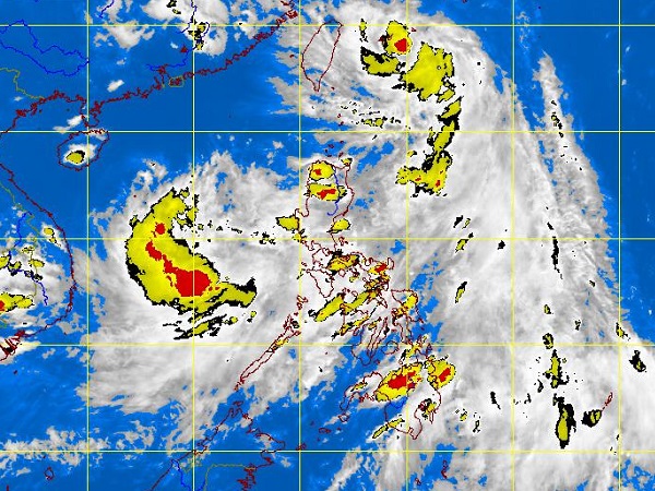
MANILA, Philippines – While tropical storm “Emong” has yet to leave the Philippine area of responsibility, another weather disturbance that that may intensify into a cyclone is being monitored by the state weather bureau Wednesday afternoon.
The low-pressure area (LPA) was last spotted 550 kilometers west of San Jose, Occidental Mindoro, the Philippine Atmospheric, Geophysical and Astronomical Services Administration said (Pagasa).
Although weather disturbances brewing from the west are less likely to make landfall, Pagasa is not discounting the possibility that it would hit land. It will also bring heavy rains and enhance the southwest monsoon.
The LPA, which has a 50-50 chance of becoming a cyclone according to Pagasa, will be called “Fabian” once it intensifies.
Storm “Emong,” meanwhile, was last observed 370 kilometers northeast of Basco, Batanes packing maximum sustained winds of 75 kilometers per hour near the center and gustiness of up to 90 kph.
It is forecast to move north northwest at 19 kph.
“Luzon will experience monsoon rains. Visayas will be cloudy with light to moderate rainshowers and thunderstorms. Mindanao will have partly cloudy to cloudy skies with isolated rainshowers or thunderstorms mostly in the afternoon or evening,” Pagasa said.
“Moderate to strong winds blowing from the southwest to south will prevail throughout the archipelago and the coastal waters will be moderate to rough,” it added.
