MANILA, Philippines—Metro Manila sizzled at 35 degrees Celsius (95 degrees Fahrenheit) on Wednesday but the state weather bureau said this could still not be considered a “heat wave.”
A heat wave is said to occur when the temperature reaches three degrees higher than the average for at least three consecutive days, said forecaster Jori Loiz of the Philippine Atmospheric, Geophysical and Astronomical Services Administration (Pagasa). In Metro Manila, 35 degrees Celsius is the average temperature during summer.
Pagasa made the 35 degree temperature reading at 3 p.m. at the agency’s Science Garden in Quezon City. At 4 p.m., the mercury rose further to 35.3 degrees Celsius, just a notch below the highest Metro Manila temperature so far in 2013—35.4 degrees Celsius, recorded on April 5.
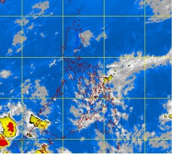
Easterlies, or warm, humid winds, from the Pacific Ocean continue to blow, affecting the eastern section of the country.
In its weather outlook for Thursday, Pagasa said Metro Manila and the rest of the country will be partly cloudy with isolated rain showers or thunderstorms.
Cagayan Valley and the Cordillera Administrative Region will have cloudy skies with light to moderate rain showers and thunderstorms.
Moderate to strong winds blowing from the northeast will prevail over extreme Northern Luzon and its coastal waters will be moderate to rough, Pagasa said. Elsewhere, winds will be light to moderate coming from the east to northeast with slight to moderate seas, it added.
