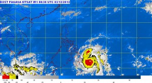
Weather forecasters said Pablo will make a landfall between Davao Oriental and Surigao Del Sur around 4 a.m. to 6 a.m. Tuesday and could weaken as it moves towards Palawan.
Public storm warning No.3 was hoisted in Surigao del Norte, Siargao, Surigao del Sur, Dinagat Province, Agusan del Norte, Agusan del Sur, Misamis Oriental, Bukidnon, Davao Oriental, Compostela Valley and Davao del Norte including Samal Island.
Winds of 101-185 kilometers per hour are expected in at least 18 hours in these areas, the Philippine Atmospheric Geophysical and Astronomical Services Administration said.
Signal No.2, or winds of 61-100 kph expected within the next 24 hours, was declared in Southern Leyte, Bohol, Southern Cebu, Negros Oriental, Siquijor, : Misamis Occidental, Lanao del Norte, Lanao del Sur, North Cotabato and Zamboanga del Norte.
Meanwhile, areas under signal No.1 were Northern Palawan including Calamian Group of Islands and Cuyo Island, Eastern Samar, Western Samar, Leyte including Biliran, Aklan, Capiz, Antique, Iloilo, Guimaras, Negros Occidental and Rest of Cebu including Camotes Islands, Zamboanga del Sur, Maguindanao, Sultan Kudarat, Sarangani and South Cotabato. Winds of 45-60 kph are expected within the next 36 hours in these areas.
Pablo was last located 390 kilometers southeast of Hinatuan, Surigao del Sur, and packed maximum sustained winds of 175 kph near the center and gustiness of up to 210 kph. It was forecast to move west northwest at 24 kph.
The typhoon is expected to be in the vicinity of Cagayan de Oro City by Tuesday afternoon 110 km southwest of Iloilo City by Wednesday afternoon and 330 km west of Calapan City, Oriental Mindoro by Thursday afternoon.
Pablo was seen to bring heavy to intense rains within its 600 km diameter.
Fishing boats and other small sea craft were advised by the weather bureau not to venture out into the eastern Seaboards of Visayas and Mindanao.
Residents living in low lying and mountainous areas under public storm warning signals were alerted against possible flash floods and landslides. Likewise, those living in coastal areas under public storm warning signal no. 3 and signal no.2 were alerted against big waves or storm surges generated by typhoon Pablo.
Aquino appeals to Mindanao, Visayas residents
President Benigno Aquino III made a last-minute appeal to residents in Visayas and Mindanao on Monday afternoon to heed authorities’ warning to evacuate to safer ground, repeatedly reminding them not to take typhoon “Pablo’’ lightly.
“I hope that we don’t give our search and rescue teams some problems. If our LGUs advise us in the danger areas to evacuate, we should follow this immediately and not wait for the third, fourth or fifth time that they come to us before we move to more secure ground,’’ the President said in a televised address.
“I repeat: I’m facing you now because the incoming storm is no laughing matter,’’ he added, pointing out that the typhoon has been packing strong gusts of winds and threatening to dump a large volume of water. “The government is ready. We expect the cooperation of everyone so that nobody gets in harm’s way.’’
The President said that the Department of Interior and Local Government has ordered local government units in provinces lying in the path of the typhoon to evacuate residents ahead of its landfall.
Sail ban
Aquino also appealed to operators of “colorum bancas’’ against setting out to sea in view of the stormy weather. This is on top of the Coast Guard’s order to sea craft not to sail.
The President reported that all government agencies were on alert for the impact of the typhoon, seen as the most powerful storm to cross the archipelago in 2012.
The National Disaster Risk Reduction and Management Council has gone on red alert. The Department of Social Welfare and Development has “prepositioned’’ some P42.2 million in food packs and relief goods and standby fund, he said.
The Armed Forces of the Philippines has also pre-positioned search and rescue vehicles, while the Philippine National Police has prepared for evacuation operations. The Department of Public Works and Highways has also pre-positioned heavy equipment in areas likely to be hit by the storm, he added.
“I talked with some congressmen and they were telling me that some of their constituents doubted that the storm would blow their way because it was very sunny in their areas. Well, the storm has a very wide diameter, about 600 kilometers. We’re only seeing more or less 25 miles. I hope we take all this seriously,’’ he said.
“We can’t stop its entry, but we can minimize the damage it would wreak on life and property if we help and cooperate with one another,’’ he added. With a report from TJ Burgonio, Philippine Daily Inquirer