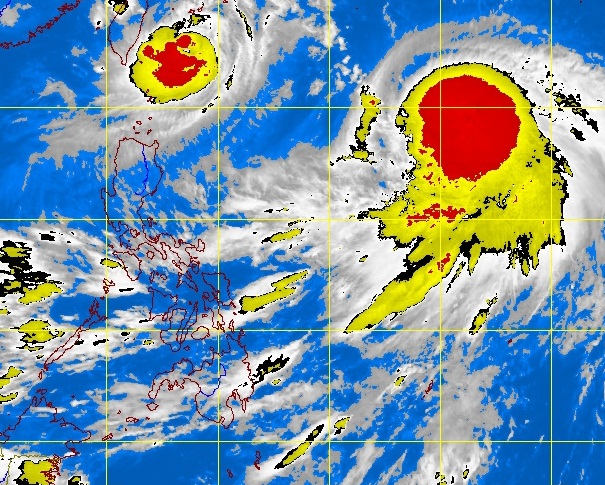
2 merging typhoons don’t worry Pagasa
There’s a chance that exiting Typhoon “Igme” (international name Tembin) will meet the approaching Typhoon “Julian” (Bolaven) in the next 24 hours but weathermen do not see strong interaction between them.
In its 5 p.m. advisory, the Philippine Atmospheric, Geophysical and Astronomical Services (Pagasa) raised the storm signal No. 2 warning over the Batanes group of islands, indicating winds of 61-100 kph.
As of 4 p.m., Igme slightly weakened as it moved towards Taiwan, packing maximum sustained winds of 130 kph and gusts of 160 kph. Its eye was observed at 290 kilometers north northeast of Basco, Batanes, Pagasa said.
“It will probably make landfall in Taiwan by (Thursday) morning,” said Pagasa forecaster Nikos Peñaranda.
Igme may still be inside the country’s territory when another weather disturbance, Julian, enters the Philippine area of responsibility, he said in a radio interview.
Article continues after this advertisement“Yes, while Igme is exiting on Thursday afternoon, Julian may enter the Philippine area of responsibility tomorrow afternoon or Friday morning. There’s a possibility they will meet, Peñaranda said.
Article continues after this advertisementEven so, “there’s only a minimal chance of strong interaction between them or the Fujiwara effect,” he said, referring to the phenomenon defined by the US National Weather Service as the tendency of two nearby storms to move around a common pivot.
Instead, what may happen, according to Peñaranda, is that Igme’s exit will be slower than predicted.
As of early Wednesday, Julian was observed 1,470 km east of northern Luzon. It is not expected to directly hit land and may only enter a corner of the Philippine area of responsibility “far from the Luzon landmass,” the forecaster said.
Some areas in the eastern seaboards of Luzon will experience strong waves, and fishing boats and other small seacraft were advised against venturing out into the sea, Pagasa said.
Igme is still seen to bring moderate to heavy rainfall, of 10–20 millimeters per hour, within its 500-km diameter.
Metro Manila and other western sections of Luzon will experience sporadic rains. The weekend may bring heavier rainfall, especially on Sunday, because of the southwest monsoon being pulled by incoming Julian, Peñaranda said.
But Pagasa does not expect strong, continuous rainfall similar to what happened earlier this month.
