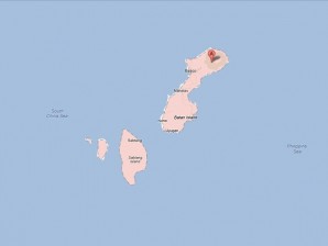
As of 10 a.m., the eye of the typhoon was spotted 285 kilometers northeast of Basco, Batanes, packing maximum sustained winds of 120 kph near the center and gustiness of up to 150 kph, the Philippine Atmospheric, Geophysical and Astronomical Services Administration said.
Gener was still plodding along in a north-northwest direction at 7 kph, a Pagasa bulletin issued at 11 a.m. said.
While the typhoon lingered, a low pressure area was spotted 360 km west northwest of Basco, Batanes but it was still unclear if it would strengthen into a storm. If it does, it will be named “Helen.”
The Philippines’ northernmost groups of islands, Batanes, Calayan and Babuyan, were placed under public storm warning Signal No. 2, while Signal No. 1 was raised over the rest of Cagayan and Apayao.
Gener was still enhancing the southwest monsoon that has been bringing rains and moderate to strong winds over Luzon, including Metro Manila, and Western Visayas, Pagasa said.
The storm was also expected to continue dumping heavy to torrential rainfall, or from 10 to 35 mm per hour, within an area 700 kilometers across, Pagasa said.
Adjusting a previous forecast that Gener would be out of the Philippine area of responsibility by Thursday, Pagasa said the storm was now expected to exit Friday morning, when its eye is expected to be 580 km north northwest of Basco, Batanes, or 120 km north northwest of Taipei in Taiwan.
By Thursday morning, it will be 400 km north northeast of Basco, Batanes, Pagasa said.
The weather bureau reiterated its warning for people living in low-lying and mountainous areas that might be hit by flash floods and landslides.
Likewise, those living in coastal areas under Public Storm Signal No. 2 were alerted to the possibility of big waves or storm surges.