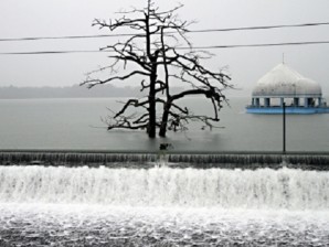
Red alert up in La Mesa dam
MANILA, Philippines – The management of the La Mesa Dam recommended the evacuation of residents near the Tullahan River as the water level at the dam threatened to overflow Sunday.
As of 2 p.m. , the Philippine Atmospheric, Geophysical and Astronomical Services Administration (Pagasa) said the water level at the dam reached 79.59 meters, 56 centimeters near the spilling level of 80.15 meters.
The La Mesa Dam authorities have hoisted the red alert, calling for the discretion of the local governments, particularly villages along the Tullahan River, in evacuating residents.
Spillage from the dam is anticipated to bloat the Tullahan River and possibly affect portions of Quezon City, Valenzuela, Navotas and Malabon.
Sunday’s water level slightly increased from Saturday’s 79.42 meters as scattered rainshowers caused by Tropical Storm “Gener” continued in Metro Manila.
Article continues after this advertisementPublic storm signal warnings were hoisted Sunday over portions of northern Luzon as Gener slightly intensified as it continued its slow approach to the country’s northernmost tip.
Article continues after this advertisementPagasa warned that any form of sea travel in the affected areas would be risky as it raised signal number two over the Cagayan Province, including the Calayan and Babuyan Group of Islands. The weather bureau also warned the public of sustained winds of 60 to 100 kilometers per hour until Monday.
The agency reminded residents living in coastal areas under storm signal number two to be on alert for big waves and storm surges generated by Gener.
Storm signal number one was hoisted over the provinces of Isabela, Kalinga, Apayao and the Batanes Group of Islands, where winds of 30 to 60 kph is expected until Tuesday, with the weather bureau advising against traveling on small sea craft and fishing boats.
Cagayan Province, including the Calayan and Babuyan Group of Islands, will experience stormy weather while provinces with storm signal number one in effect will have rains with gusty winds and coastal waters are anticipated to be rough.
The rest of Luzon and the Visayas will experience cloudy skies with scattered to widespread rainshowers and thunderstorms while Mindanao will be cloudy and may have isolated rainshowers and thunderstorms.
Moderate to strong winds blowing from the southwest will prevail over southern Luzon, the Visayas and Mindanao while winds from the northeast to northwest will prevail over the rest of Luzon. Coastal waters in the areas will be moderate to rough.
Based on the Pagasa weather bulletin, as of 10 a.m., on Sunday, the eye of tropical storm Gener was estimated at 310 kilometers east-northeast of Casiguran, Aurora, with maximum sustained winds of 85 kph near the center and gustiness of up to 100 kph.
By Monday, Gener is anticipated to be at 260 kilometers east-northeast of Aparri, Cagayan, as it continues to move north-northwest at 15 kph. On Tuesday, data gathered by the weather bureau revealed that the tropical storm could be 160 kilometers northeast of Basco, Batanes, and on its way out by Wednesday, when it is expected to be 350 kilometers north of Basco, Batanes, or 40 kilometers east of Taiwan.
Pagasa warned residents living in low-lying and mountainous areas under public storm warning signals to be on alert against flashfloods and landslides and to anticipate heavy to intense rainfall within the 600 km-diameter of Gener.
The tropical storm is likewise expected to enhance the southwest monsoon and bring rains over Southern Luzon, the Visayas, and Mindanao, particularly its western section.
It further advised fishing boats and other small vessels to avoid venturing into the seaboards of central and southern Luzon, the Visayas, and the eastern seaboard of Mindanao due to the combined effect of Gener and the southwest monsoon.
