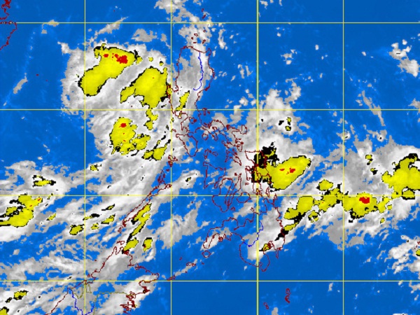
MTSAT ENHANCED IR Satellite Image for 7:32 a.m., 04 July 2012
MANILA, Philippines — The low pressure area that brought non-stop rains Tuesday in parts of Luzon, including Metro Manila, is on its way out but rains are expected to continue throughout Wednesday, the state weather bureau said.
As of 2 a.m., the low pressure area was seen 60 kilometers north- northwest of Iba, Zambales, the Philippine Atmospheric Geophysical and Astronomical Services Administration said.
The LPA may also dissipate by Wednesday afternoon, it also said.
No thunderstorm developed for the past five hours within Metro Manila as of 4:30a.m., it added.
A new low pressure area in the Pacific is, however, being monitored by the state weather bureau.
Luzon and Visayas will experience mostly cloudy skies with scattered rainshowers and thunderstorms becoming cloudy with widespread rains over the western sections of Northern and Central Luzon which may trigger flashfloods and landslides.
Meanwhile, Mindanao will have partly cloudy to cloudy skies with isolated rainshowers or thunderstorms.
Moderate to strong winds blowing from the southwest to southeast will prevail over Northern Luzon and coming from southwest over the rest of Luzon and Visayas and the coastal waters along these areas will be moderate to rough.
Elsewhere, winds will be light to moderate coming from south to southwest with slight to moderate seas, Pagasa said.