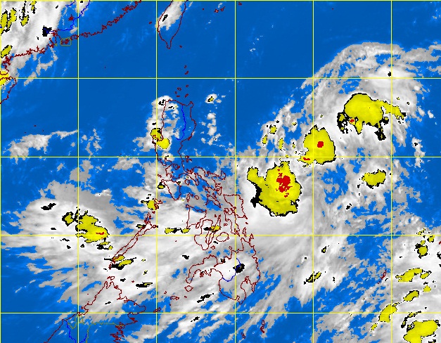
MTSAT ENHANCED IR Satellite Image for 5:32 p.m., 26 June 2012
MANILA, Philippines— “Dindo” has developed into a storm, the fourth to hit the country this year, after intensifying from a low pressure area, the state weather bureau said Tuesday afternoon.
As of the latest report of the Philippine Atmospheric, Geophysical and Astronomical Services Administration (Pagasa), “Dindo” was seen 670 kilometers east of Virac, Catanduanes and moving west-northwest at 19 kilometers per hour.
Pagasa said that as of 4 p.m. Tuesday, the storm had maximum sustained winds of 55 kilometers per hour and the estimated rainfall amount was 10 to 15 millimeters per hour, considered as heavy, within the 400 kilometer diameter of the storm.
Fishing boats and sea vessels have been advised to refrain from going out to sea in the eastern seaboard of the country due to possible big waves and rough seas, Pagasa said.
If it maintains its present course, “Dindo” is expected to be at 520 km east of Casiguran, Aurora Wednesday afternoon. By Thursday, it is expected to be at 320 kilometers east of Aparri, Cagayan, Pagasa said.
By Friday afternoon, it is expected to be at 80 km north-northeast of Basco, Batanes, Pagasa said.