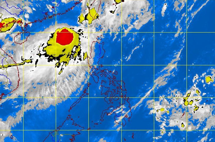
MTSAT ENHANCED IR Satellite Image for 5:32 p.m., 19 June 2012
MANILA, Philippines – Following the exit of typhoon Butchoy (international name Guchol), a new weather disturbance has inched closer to the country but would only stay briefly, the state weather bureau said Tuesday.
Tropical storm Talim, which will be named Carina once it enters the Philippine area of responsibility, was seen 570 kilometers west of extreme northern Luzon as of 2 p.m., the Philippine Atmospheric Geophysical and Astronomical Services Administration said.
Talim has punching power of 75 kilometers per hour with gustiness of up to 90 kph. It was plotted moving northeast at 22 kph.
“There’s a chance it will enter the country but it will only brush the edges of the western part of northern Luzon,” Samuel Duran, weather forecaster, said in Filipino.
He added that it will enter between Taiwan and Hong Kong, but only between 12 and 24 hours.
Talim will not have a direct effect but will enhance the southwest monsoon in the country.
He said that based on forecast models, no public storm signals will be raised in the Philippines.
Talim is forecast to enter the county on Wednesday afternoon.
Meanwhile, forecasters said a shallow low pressure area was seen in the West Pacific and may enter the country Wednesday afternoon.
“If it will not diffuse, it will bring rains in eastern Mindanao and Visayas,” Duran added.
Northern and Central Luzon will have occasional rain showers becoming frequent over the western sections which may trigger flashfloods and landslides. Meanwhile, the rest of the country will be partly cloudy to cloudy with isolated rainshowers or thunderstorms, Pagasa said in its 5 p.m. update.