





Eye of Typhoon Uwan enters PAR, says Pagasa


READ: LIVE UPDATES: Typhoon Uwan
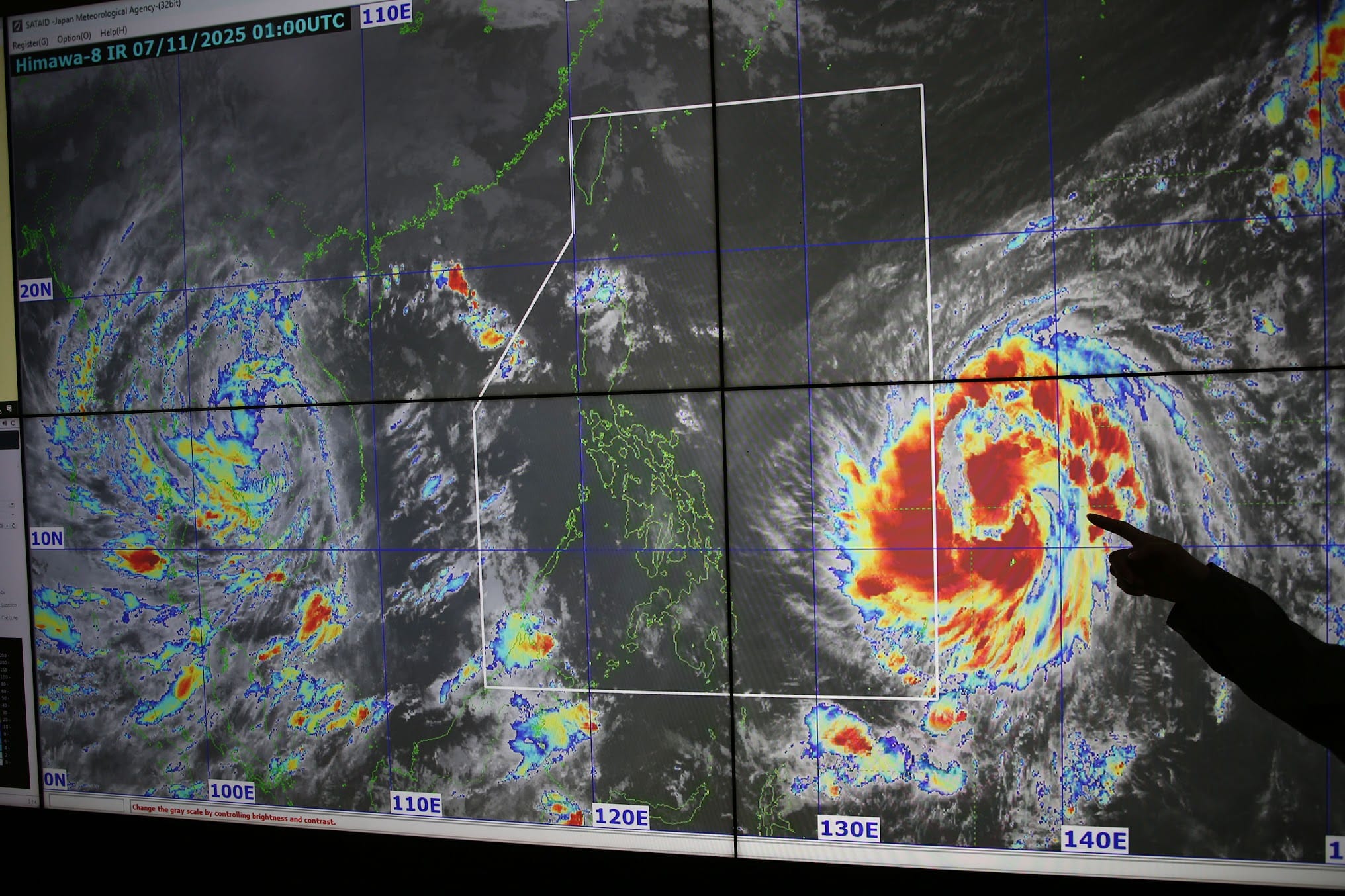
MANILA, Philippines — The eye of Uwan (International name: Fung-wong) entered the Philippine area of responsibility (PAR) on Friday night, after intensifying into a typhoon-category cyclone, state meteorologists said.
Updates from the Philippine Atmospheric, Geophysical and Astronomical Services Administration (Pagasa) as of 10:00 p.m. showed that Uwan’s eye has crossed the PAR border.
“At 10 p.m. today (November 07), the center of Typhoon Uwan has entered the PAR. The next Tropical Cyclone Bulletin will be issued at 11:00 PM today,” Pagasa said.
Just minutes before this update, Pagasa released a bulletin stating that Uwan is now packing maximum sustained winds of 120 kilometers per hour (kph) near the center, and gustiness of up to 150 kph.
It was last reported to be moving west northwestward, at a speed of 20 kph.
“As of 8:00 p.m. today, 07 November 2025, Severe Tropical Storm ‘Uwan’ (Fung-wong) has intensified into a Typhoon and is being monitored outside the Philippine Area of Responsibility (PAR),” Pagasa said.
“All are advised to monitor updates from DOST-PAGASA,” it added.
Earlier, Pagasa Assistant Weather Services Chief Chris Perez said that most areas in the country can expect fair weather from Friday night to Saturday morning, with Uwan only starting to affect eastern parts of the country by afternoon.
According to Perez, only isolated rain showers would be expected on Friday night, but several areas would be under rainfall warnings from Saturday afternoon to Sunday afternoon — particularly Bicol Region provinces of Camarines Sur, Albay, and Catanduanes, which are all under a red rainfall warning.
A red rainfall warning means these areas would receive more than 200 millimeters (mm) of rain.
READ: Fair weather on Saturday morning, but rains start by afternoon
By Sunday afternoon to Monday afternoon, Perez said that the concentration of rains would be over Northern Luzon and some provinces in Central Luzon, particularly Aurora and Nueva Ecija.
The remaining provinces in Central Luzon, along with Metro Manila and Calabarzon, will be under an orange rainfall warning.
Uwan is expected to make landfall over Isabela by Monday, but Perez said at the start of the briefing that other eastern provinces in Luzon — and not only Isabela — should prepare for a possible landfall scenario as the cone of probability still shows that the cyclone may deviate from its current path.
Perez noted that Pagasa’s cone of probability is still huge — which means a southward change would put Bicol Region, particularly Camarines Sur, Camarines Norte, Southern Luzon, and even Metro Manila in its crosshairs.
A northward movement, meanwhile, may result in Uwan hitting northeastern Cagayan and the extreme northern Luzon area. /mr


