
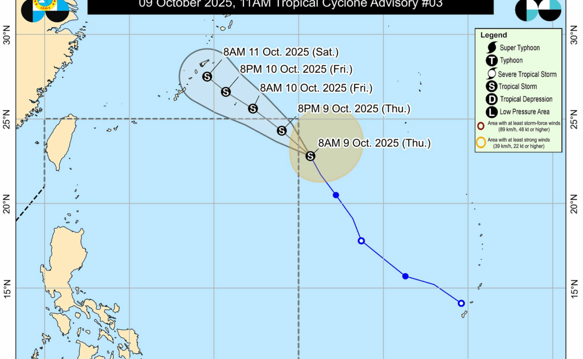
Pagasa’s map showing the Track and Intensity Forecast of Tropical Storm Nakri
MANILA, Philippines — Tropical Storm Nakri slightly intensified as it approached the northeastern boundary of the Philippine Area of Responsibility (PAR) but is not expected to directly affect the country, the state weather bureau said Thursday, Oct. 9.
In its 10 a.m. update, the Philippine Atmospheric, Geophysical and Astronomical Services Administration (Pagasa) reported that Nakri was last located 1,445 kilometers east-northeast of extreme northern Luzon.
The storm packed maximum winds of 75 kilometers per hour (kph) with gusts of up to 90 kph, moving northwestward at 25 kph, and is forecast to maintain this motion.
Although Nakri is likely to enter PAR on Friday afternoon or evening, Pagasa said it will not directly affect the weather or sea conditions in the Philippines, and no tropical cyclone wind signals will be hoisted.
READ: Rain expected across PH due to thunderstorms, southwesterly windflow
However, the southerly and northeasterly windflows will bring strong to gale-force gusts to some portions of the country.
Meanwhile, a new low-pressure area is being monitored inside PAR. According to Pagasa, it is unlikely to develop into a tropical depression within the next 24 hours. /mcm/abc