





Severe Tropical Storm Opong makes second landfall


READ: LIVE UPDATES: Typhoon Opong
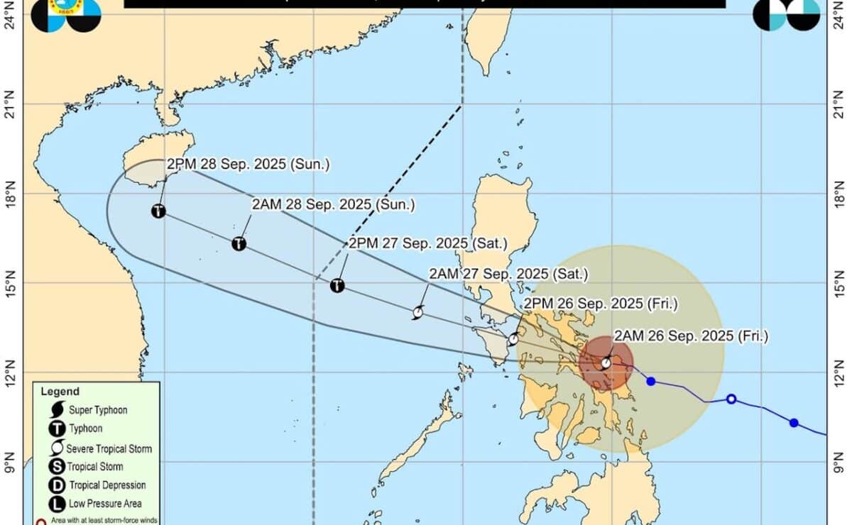
A map released by the state weather bureau on Friday, September 26, 2025, shows the track and intensity forecast for Severe Tropical Storm Opong. — Photo from Pagasa
MANILA, Philippines — Severe Tropical Storm Opong made a second landfall in Palanas in Masbate province, causing its weakening, on Friday morning, Pagasa said.
As of 5 a.m., the center of Opong was estimated to be near Palanas town, packing maximum sustained winds of 110 kilometers per hour (kph) with gusts of 150 kph, moving west-northwestward at 30 kph, according to Pagasa weather specialist Loriedin Dela Cruz-Galicia.
“Opong has slightly weakened; now it is just a severe tropical storm, but its wind strength is still significant,” Dela Cruz-Galicia said in a public weather forecast. “Its movement has become fast in the past hours.”
Before its landfall, Opong had intensified into a typhoon on Thursday night.
READ: Signal No. 4 raised in several areas as Opong intensifies into typhoon
Opong made a second landfall at the said area at 4 a.m., while its first landfall was at San Policarpo, Eastern Samar, at 11:30 p.m. Thursday, according to Dela Cruz-Galicia.
Another landfall could occur in Mimaropa (Occidental Mindoro, Oriental Mindoro, Marinduque, Romblon, and Palawan) in the coming hours, she added.
Dela Cruz-Galicia noted that the “diameter” of Opong was quite large, affecting many areas nationwide.
To date, Opong brings 16 areas under Tropical Cyclone Wind Signal (TCWS) No. 3, 19 areas under TCWS No. 2, and 25 areas under TCWS No. 1. /das/abc


