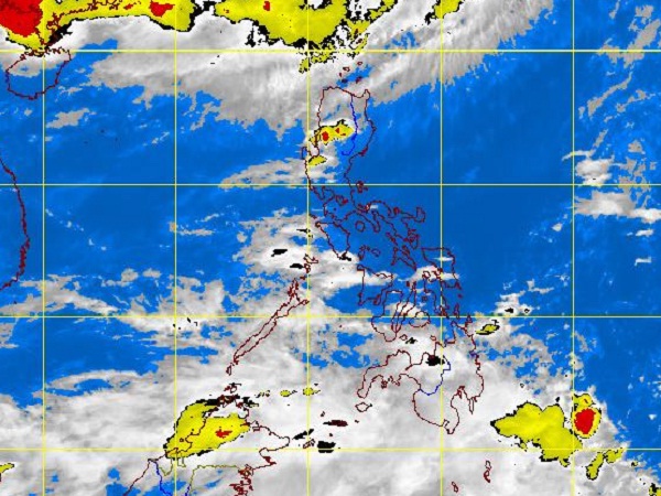
MTSAT ENHANCED IR Satellite Image for 5:32 p.m., 12 June 2012
MANILA, Philippines – A second storm might enter the Philippine territory on Thursday or Friday morning, the state weather bureau said Tuesday.
The weather disturbance was last seen 1,730 kilometers east of southern Mindanao, moving at 11 kilometers per hour as of 2 p.m., the Philippine Atmospheric Geophysical and Astronomical Services Administration said.
Once it enters the country, it will be named Butchoy.
Meanwhile, rains will continue in parts of the country due to a shallow low pressure area in Mindanao and southwest monsoon in Luzon, Pagasa’s 5 p.m. bulletin said.
The shallow low pressure area was plotted 110 kilometers southwest of Cotabato City.
Northern and western Luzon will experience monsoon rains, it said.
Mindanao and Western Visayas region will mostly have cloudy skies with scattered rainshowers and thunderstorms becoming cloudy with widespread rains over Davao provinces, Southern Mindanao and Zamboanga provinces, which may trigger flash floods and landslides, Pagasa said.
The rest of the country will be partly cloudy to cloudy with isolated rainshowers or thunderstorms.
Moderate to strong winds blowing from southwest will prevail over Luzon and Western Visayas and the coastal waters along these areas will be moderate to rough. Elsewhere, winds will be light to moderate coming from the southwest with slight to moderate seas, it added.