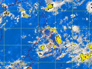
The Pacific Ocean is starting to get busy, with two disturbances expected to influence local weather this week.
The Philippine Atmospheric Geophysical and Astronomical Services Administration (Pagasa) said a low pressure area had formed near Catanduanes while a potential tropical cyclone was brewing east of Mindanao.
The LPA in Catanduanes is not expected to become a tropical cyclone, according to forecaster Samuel Duran. He described the LPA as “shallow” and said it “would not affect Metro Manila.”
The disturbance, which was spotted 270 kilometers northeast of Virac, Catanduanes, early on Monday morning, would bring overcast skies and rains over the Bicol region, however, Pagasa said.
Meanwhile, the weather bureau said it was closely monitoring a mass of activity near Guam, which is seen to intensify in the coming days.
Duran said models indicated this low pressure area could become a tropical depression by Thursday and enter the country’s area of responsibility.
If it does so, it would be the first tropical cyclone to enter the country this year and would be named “Ambo,” he said. So far, the disturbance is too far to affect the Philippines, he added. Kristine L. Alave
