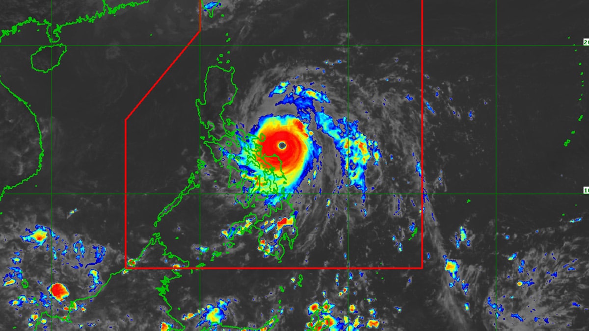
Image from DOST / Pagasa
MANILA, Philippines — Super Typhoon Pepito (international name: Man-yi) is expected to bring intense to torrential rainfall, pouring more than 200 millimeters (mm) of rain down Bicol Region over the weekend.
READ: LIVE UPDATES: Typhoon Pepito
In its 2 p.m. advisory, the Philippine Atmospheric, Geophysical and Astronomical Services Administration (Pagasa) forecast heavy rainfall over the following areas:
Saturday (Nov. 16) to Sunday afternoon (Nov. 17)
Intense to Torrential (More than 200 mm of rain)
- Catanduanes
- Camarines Sur
- Camarines Norte
Heavy to Intense (100 to 200 mm of rain)
- Albay
- Quezon
- Northern Samar
- Eastern Samar
Moderate to Heavy (50 to 100 mm of rain)
- Sorsogon
- Samar
- Leyte
- Biliran
- Masbate
Meanwhile, as Pepito is expected to traverse the country’s landmass, Pagasa warned that the super typhoon will bring intense to torrential rainfall over parts of Calabarzon, Central Luzon, Northern Luzon and the Cordillera Administrative Region.
Image from DOST / Pagasa
The state weather bureau projected heavy rainfall over the following provinces:
Sunday afternoon (Nov. 17) to Monday afternoon (Nov. 18)
Intense to Torrential (More than 200 mm of rain)
- Quezon
- Aurora
- Quirino
- Nueva Vizcaya
- Nueva Ecija
- Rizal
- Benguet
- Pangasinan
Heavy to Intense (100 to 200 mm of rain)
- La Union
- Tarlac
- Pampanga
- Bataan
- Bulacan
- Zambales
- Metro Manila
- Cavite
- Laguna
- Camarines Norte
Moderate to Heavy (50 to 100 mm of rain)
- Marinduque
- Camarines Sur
- Batangas
- Cagayan
- Isabela
- Ifugao
- Mountain Province
- Kalinga
- Abra
- Ilocos Sur
Pepito was last spotted 180 kilometers (kms) east-southeast of Virac, Catanduanes, packing winds reaching 195 kms per hour (kph) and gusts reaching 240 kph.
The super typhoon was said to be on a west-northwestward track, moving at 20 kph, with landfall expected in Catanduanes on either Saturday evening (Nov. 16) or Sunday early morning (Nov. 17).
Pagasa already hoisted Tropical Cyclone Wind Signal (TCWS) No. 5 over Catanduanes.
READ: Signal No. 5 up in Catanduanes as Pepito set to make landfall
Additionally, the following parts of the Bicol Region were put under TCWS No. 4:
- The northeastern portion of Camarines Sur (Garchitorena, Caramoan, Presentacion, Siruma, Tinambac, Goa, Lagonoy, San Jose, Tigaon, Sagñay)
- The northeastern portion of Albay (City of Tabaco, Tiwi, Malinao, Malilipot, Bacacay, Rapu-Rapu)
State meteorologists forecast Pepito to cross the Luzon landmass, emerging onto the West Philippine Sea before exiting the country’s area of responsibility on Monday, Nov. 18.

