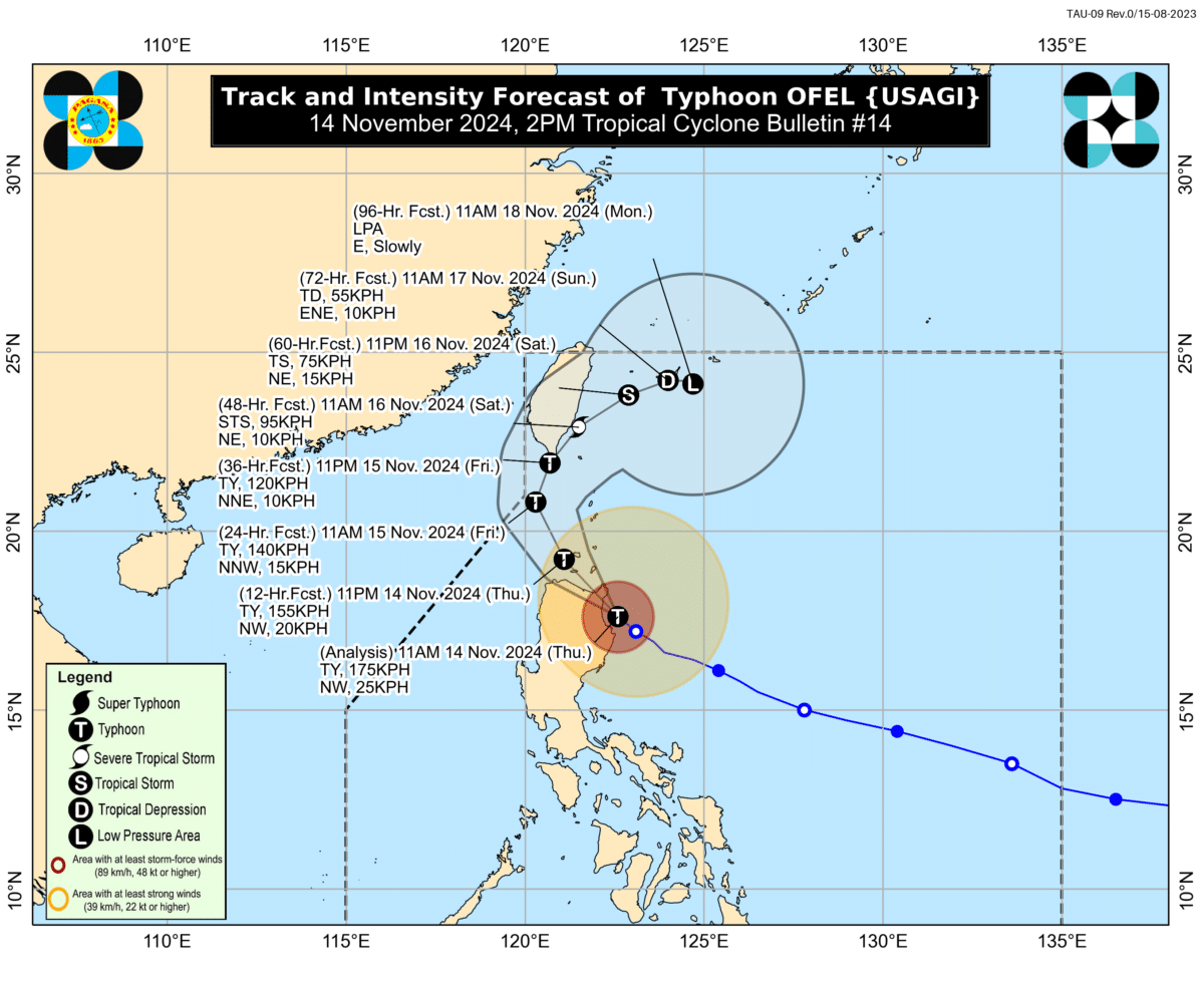
Image from the Philippine Atmospheric, Geophysical, and Astronomical Services Administration
MANILA, Philippines — Ofel (international name: Usagi) has weakened into a typhoon after making landfall over the vicinity of Baggao, Cagayan on Thursday afternoon, the state weather bureau reported.
In its 2 p.m. bulletin, the Philippine Atmospheric, Geophysical, and Astronomical Services Administration (Pagasa) reported that Ofel’s eye made landfall on the Philippine landmass at 1:30 p.m.
According to Pagasa, Ofel has weakened due to increased interaction with the Luzon landmass.
“It will continue to weaken throughout the forecast period due to frictional effects of land, as well as the increasingly unfavorable environment over the Luzon Strait and the sea east of Taiwan,” it added.
The typhoon was last located over the coastal waters of Baggao, Cagayan, packing maximum sustained winds of 175 kilometers per hour (kph) near its center and gusts of up to 240 kph.
Ofel was recorded moving west northwestward at 20 kph, the state weather bureau added.
Based on the latest forecast track, Ofel will continue crossing the northeastern portion of mainland Luzon on Thursday afternoon.
“It will then continue moving northwestward and pass close or make landfall in the vicinity of Babuyan Islands on Thursday night, before turning northward on Friday over the sea west of Batanes,” Pagasa explained.
The weather agency also underscored that hazards on land and coastal waters may still be expected in areas outside the landfall point and the forecast confidence zone.
A gale warning also remains hoisted over the northern and eastern seaboards of Northern Luzon and the eastern seaboard of Central Luzon.
READ: Super Typhoon Ofel to bring heavy rains over Luzon