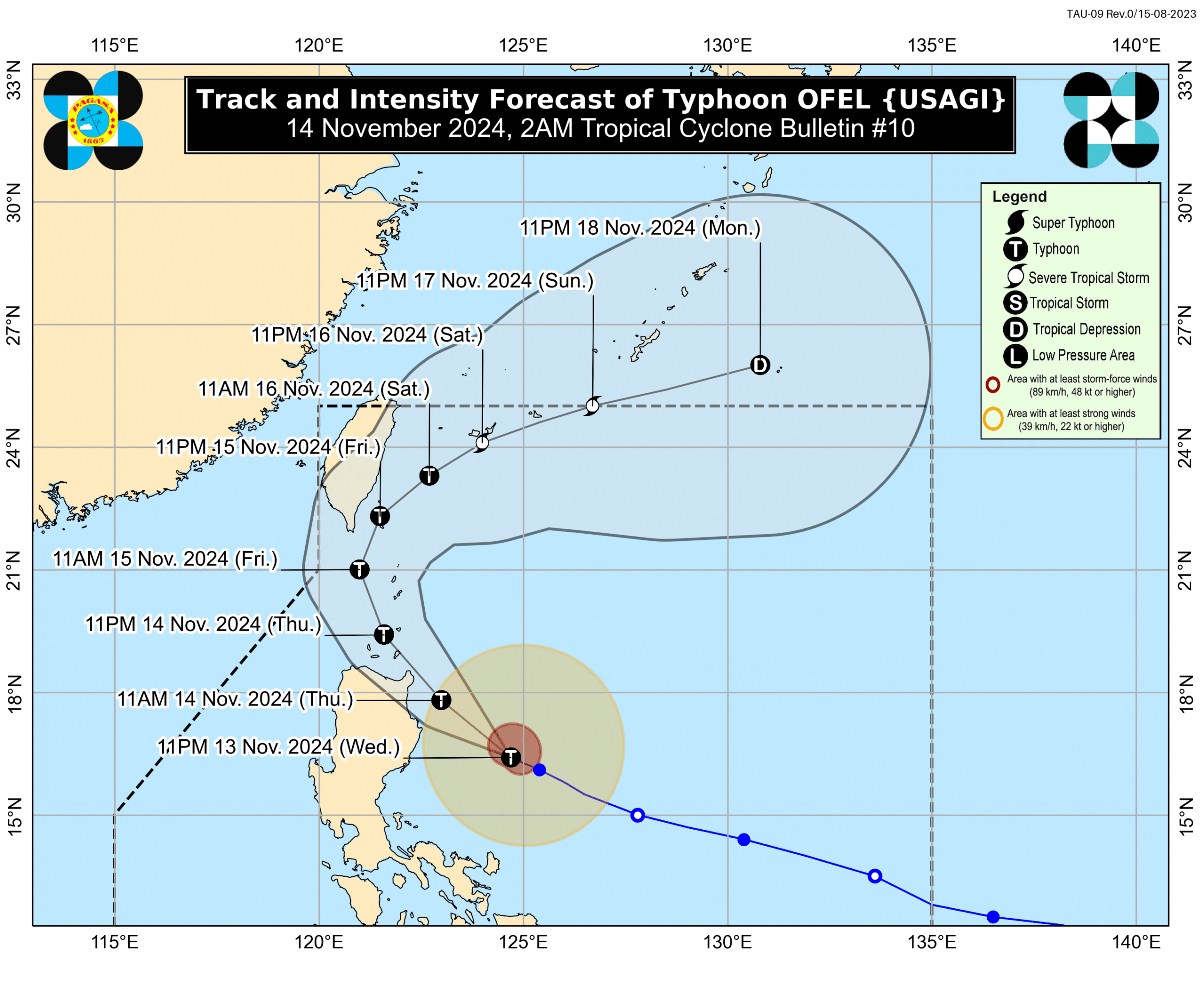
MANILA, Philippines — Typhoon Ofel (international name: Usagi) was forecast to make landfall along the eastern coast of Cagayan or Isabela today (Thursday), the same day that Tropical Storm Man-yi would enter the Philippine area of responsibility (PAR).
According to the 5 p.m. bulletin of the Philippine Atmospheric, Geophysical and Astronomical Services Administration (Pagasa) on Wednesday, the center of Ofel was located 480 kilometers east of Baler, Aurora, and was moving west-northwestward with a speed of 25 kilometers per hour (km/h).
Ofel would emerge over the Luzon Strait by Friday and might make another landfall or pass close to the Babuyan Islands.
READ: Typhoon Ofel keeps its strength over PH Sea; Signal No. 2 up in 2 areas
Ofel was last monitored to have sustained winds of 120 km/h near the center and gustiness of up to 150 km/h.
Tropical Cyclone Signal No. 2 was raised over Cagayan, including the Babuyan Islands, the northern and eastern portions of Isabela, and the eastern portion of Apayao.
Potential ‘Pepito’
Batanes, the rest of Isabela, Quirino, the northern portion of Nueva Vizcaya, Apayao, Kalinga, Abra, Mountain Province, Ifugao, Ilocos Norte, and the northern portion of Aurora were placed under Signal No. 1.
Tropical Storm Man-yi was expected to enter PAR today, after which it would be given the local name Pepito.
The storm was located 1,965 km east of Eastern Visayas, based on Pagasa’s 11 a.m. advisory on Wednesday.
Man-yi was expected to intensify into a typhoon by Thursday afternoon or evening and reach peak intensity before making landfall over the eastern coast of Luzon on Saturday or Sunday.
The weather bureau said it was still too early to determine the specific areas that would be affected by Man-yi.
Since Man-yi would reach the typhoon category while still over the Philippine Sea, it might intensify into a supertyphoon before making landfall.