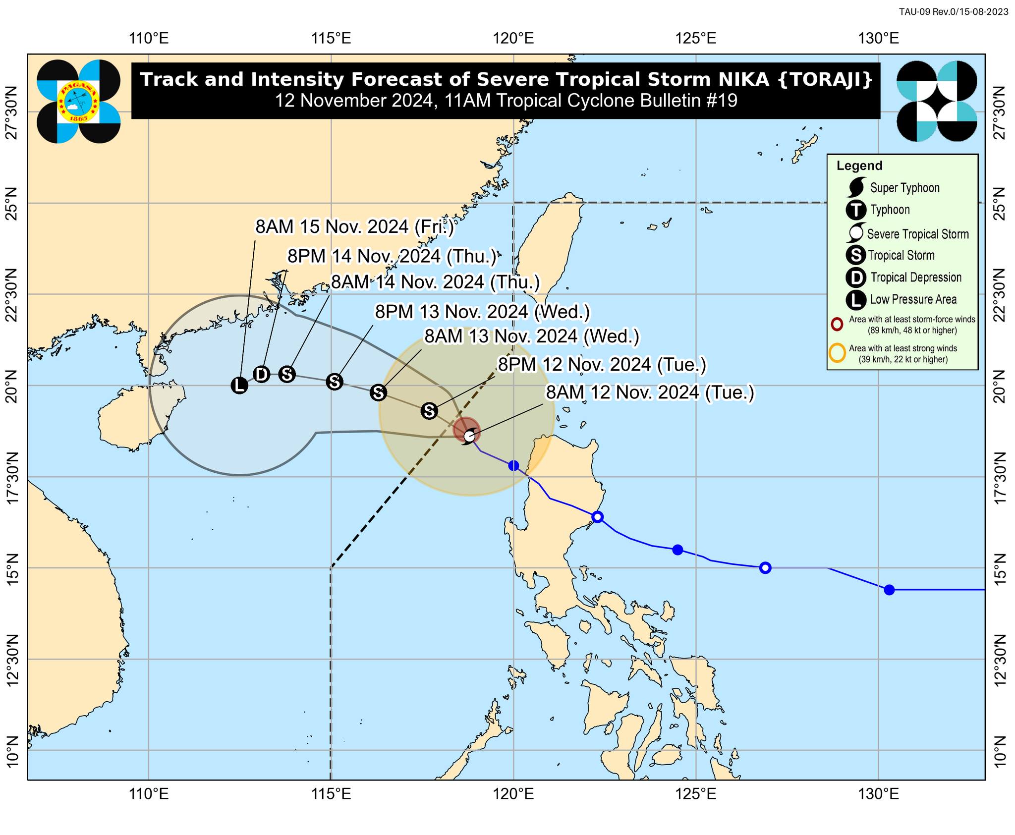
Severe Tropical Storm Nika (international name: Toraji) is expected to soon leave the Philippine area of responsibility (PAR) as it continues to move away from the country’s landmass. The Philippine Atmospheric, Geophysical, and Astronomical Services Administration (Pagasa) said their latest forecast track of Nika indicates that the storm will continue moving generally northwestward to westward over the West Philippine Sea and exit the PAR by Tuesday afternoon, November 12, 2024. Photo from Pagasa
MANILA, Philippines — Severe Tropical Storm Nika (international name: Toraji) is expected to soon leave the Philippine area of responsibility (PAR) as it continues to move away from the country’s landmass.
The Philippine Atmospheric, Geophysical, and Astronomical Services Administration (Pagasa) said in its 11 a.m. cyclone bulletin that Nika’s center was last located 225 kilometers (km) west of Laoag City, Ilocos Norte, packing maximum sustained winds of 95 kilometers per hour (kph) near its center, with gusts of up to 115 kph.
It also said Nika was moving northwestward at 10 kph.
READ: Nika to trigger storm surge at Ilocos Region; warning up
Pagasa’s latest forecast track of Nika indicates that the storm will continue moving generally northwestward to westward over the West Philippine Sea and exit the PAR by Tuesday afternoon.
“It will remain as a severe tropical storm throughout its passage within the PAR region,” the state weather agency noted.
As of mid-Tuesday, only four Northern Luzon areas remain under Tropical Cyclone Wind Signal (TCWS) No. 1. These are:
- Northern portion of Ilocos Norte (Sarrat, Piddig, Bangui, Vintar, Burgos, Pagudpud, Bacarra, Adams, Pasuquin, Carasi, San Nicolas, Dumalneg, Laoag City)
- Northern portion of Apayao (Luna, Calanasan)
- Northwestern portion of Cagayan (Abulug, Pamplona, Sanchez-Mira, Santa Praxedes, Claveria)
- Northwestern portion of Babuyan Islands (Calayan Island, Dalupiri Island, Fuga Island)
READ: LIVE UPDATES: Typhoon Nika
Areas under TCWS No. 1 may experience winds of 39 kph to 61 kph within the next 36 hours, according to Pagasa.
“This wind speed may cause very light to no damage to low-risk structures, while medium to high-risk structures may experience light damage,” it also said.
Pagasa kept its gale warning over the northern and western seaboards of Northern Luzon.


