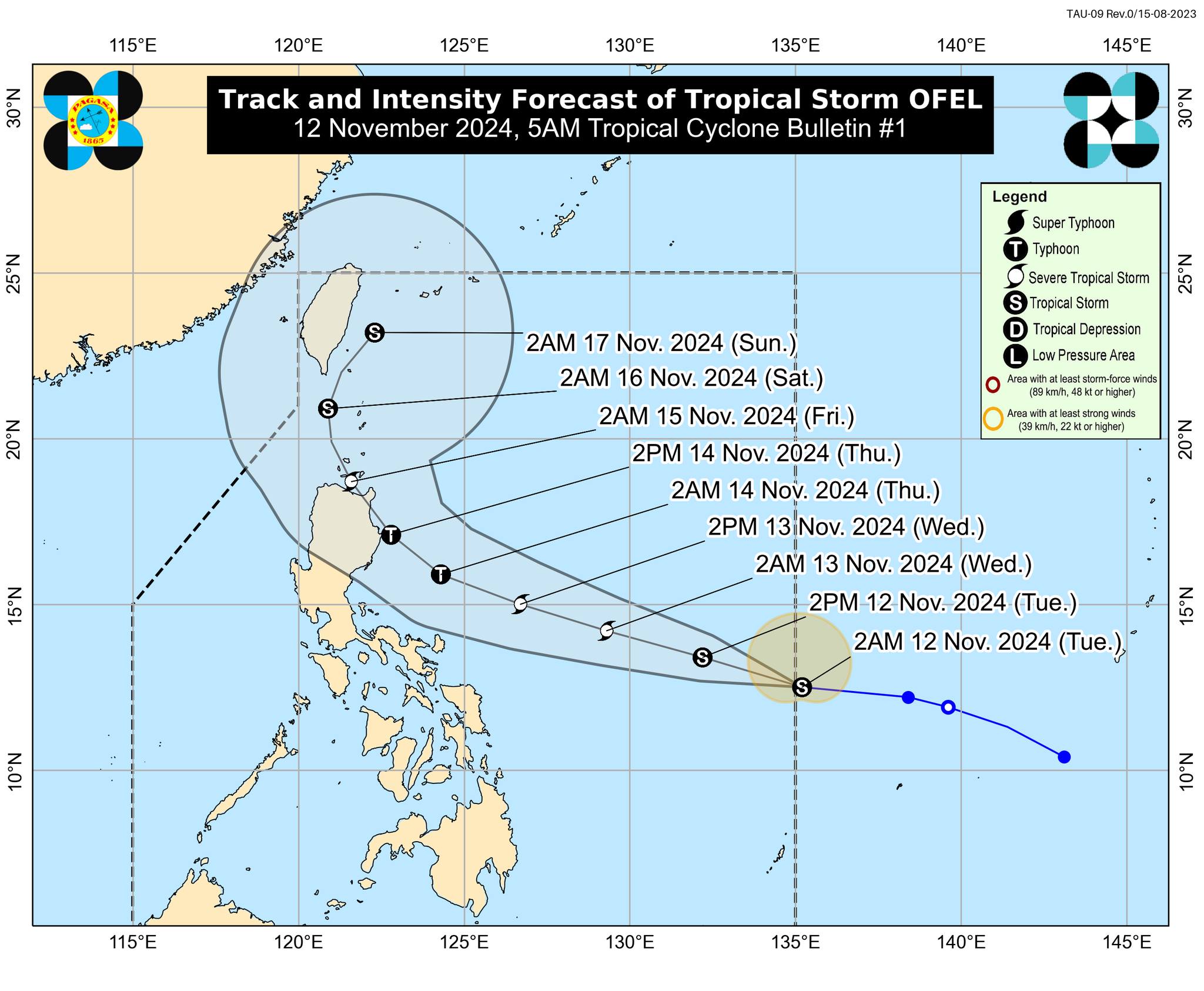
Track and intensity for Tropical Storm Ofel (international name: Usagi). – Ofel entered the Philippine area of responsibility early Tuesday morning (November 12, 2024), the Philippine Atmospheric, Geophysical, and Astronomical Services Administration (Pagasa) announced. For now, no wind signals have been raised since Ofel has no direct effect yet on any part of the country, but the state weather agency advised the public and relevant disaster risk reduction and management offices to keep monitoring for further information on the storm. Photo from Pagasa
MANILA, Philippines — Tropical Storm Ofel (international name: Usagi) entered the Philippine area of responsibility (PAR) early Tuesday morning, the Philippine Atmospheric, Geophysical and Astronomical Services Administration (Pagasa) announced.
The state weather bureau published a 5 a.m. bulletin stating that Ofel entered the PAR at 3 a.m. and was last spotted 1,170 kilometers (km) east of southeastern Luzon, packing maximum sustained winds of 75 kilometers per hour (kph) and gustiness of up to 90 kph.
Tropical Storm Ofel is moving west-northwestward at 25 kph, Pagasa added.
For now, no wind signals have been raised since Ofel has no direct effect yet on any part of the country, Pagasa noted.
READ: Incoming tropical cyclone Ofel develops into tropical storm
However, Tropical Cyclone Wind Signal No. 1 may be raised over portions of Cagayan Valley by Tuesday evening or early Wednesday morning, according to the state weather agency.
Pagasa said that based on the forecast track of Ofel, the storm would steadily intensify in the next three days and reach the typhoon category on Wednesday, November 13.
It is also expected to make landfall either over Northern Luzon or Central Luzon on Thursday afternoon or evening.
Pagasa advised the public and relevant disaster risk reduction and management offices to keep monitoring for updates on Tropical Storm Ofel.