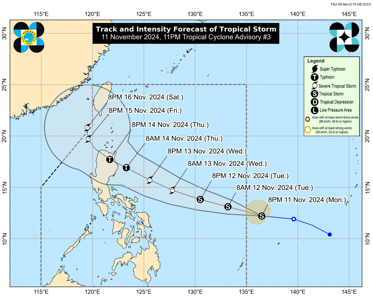
MANILA, Philippines — Another tropical cyclone set to enter the Philippine area of responsibility (PAR) developed into a tropical storm on Monday, according to state meteorologists.
The tropical storm is still outside the PAR and was last spotted 1,185 kilometers east of Eastern Visayas, packing maximum sustained winds of 65 kilometers per hour (km/h) with gustiness of 80 km/h, per Philippine Atmospheric, Geophysical and Astronomical Services Administration (Pagasa).
READ: After Nika, another typhoon may enter PAR and make landfall over Luzon
Once it enters PAR, the tropical storm will be called Ofel.
“The tropical storm will enter the PAR tomorrow (Tuesday) morning as Ofel,” Pagasa said in its 11 p.m. advisory.
After entering, it may make landfall over Northern or Central Luzon on Thursday afternoon or evening.
Prior to its landfall, Ofel may reach typhoon category on Wednesday.
“It may also hit land at or near its peak intensity,” the advisory said.
