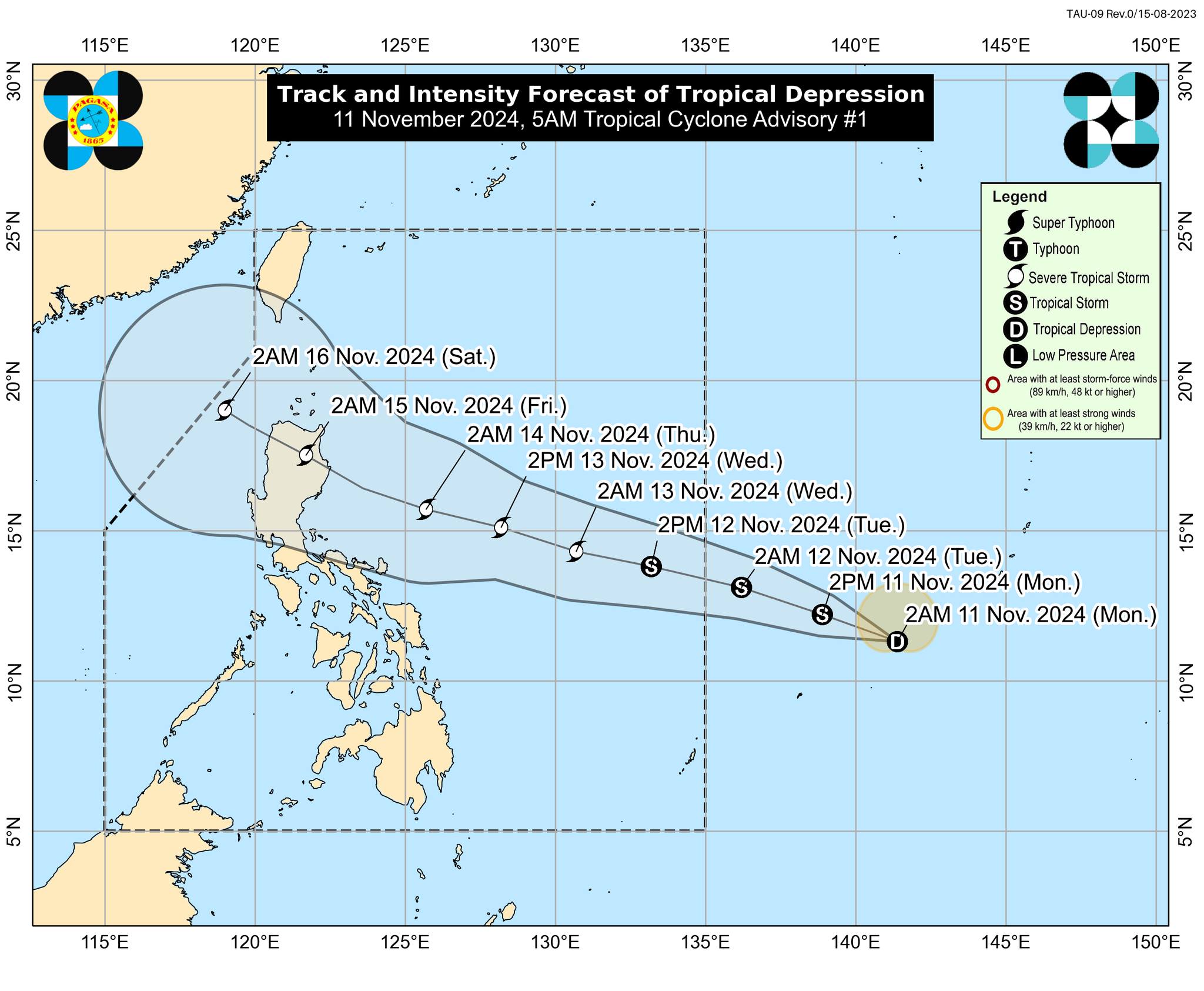
MANILA, Philippines — The low-pressure area (LPA) outside the Philippine area of responsibility (PAR) has intensified into a tropical depression, the Philippine Atmospheric, Geophysical and Astronomical Services Administration (Pagasa) reported Monday morning.
According to the state weather bureau’s 5 a.m. bulletin, the tropical depression was last spotted 1,620 kilometers (km) east of Eastern Visayas, packing maximum sustained winds of 45 kilometers per hour (kph) near its center.
It is now moving west-northwestward at 35 kph with gusts of up to 55 kph.
Based on its latest track forecast, the tropical depression will steadily move west-northwestward and may enter the PAR on Tuesday morning.
Once it enters the PAR, the typhoon will be named Ofel, marking the 15th tropical cyclone to enter the country this year.
“The tropical depression may make landfall over Northern or Central Luzon on Thursday (14 November) evening or Friday (15 November) early morning,” the state weather bureau added.
The tropical depression is expected to intensify into a severe tropical storm within the next 48 hours and may reach its peak intensity before making landfall.
READ: 2 more weather disturbances may affect PH in coming days