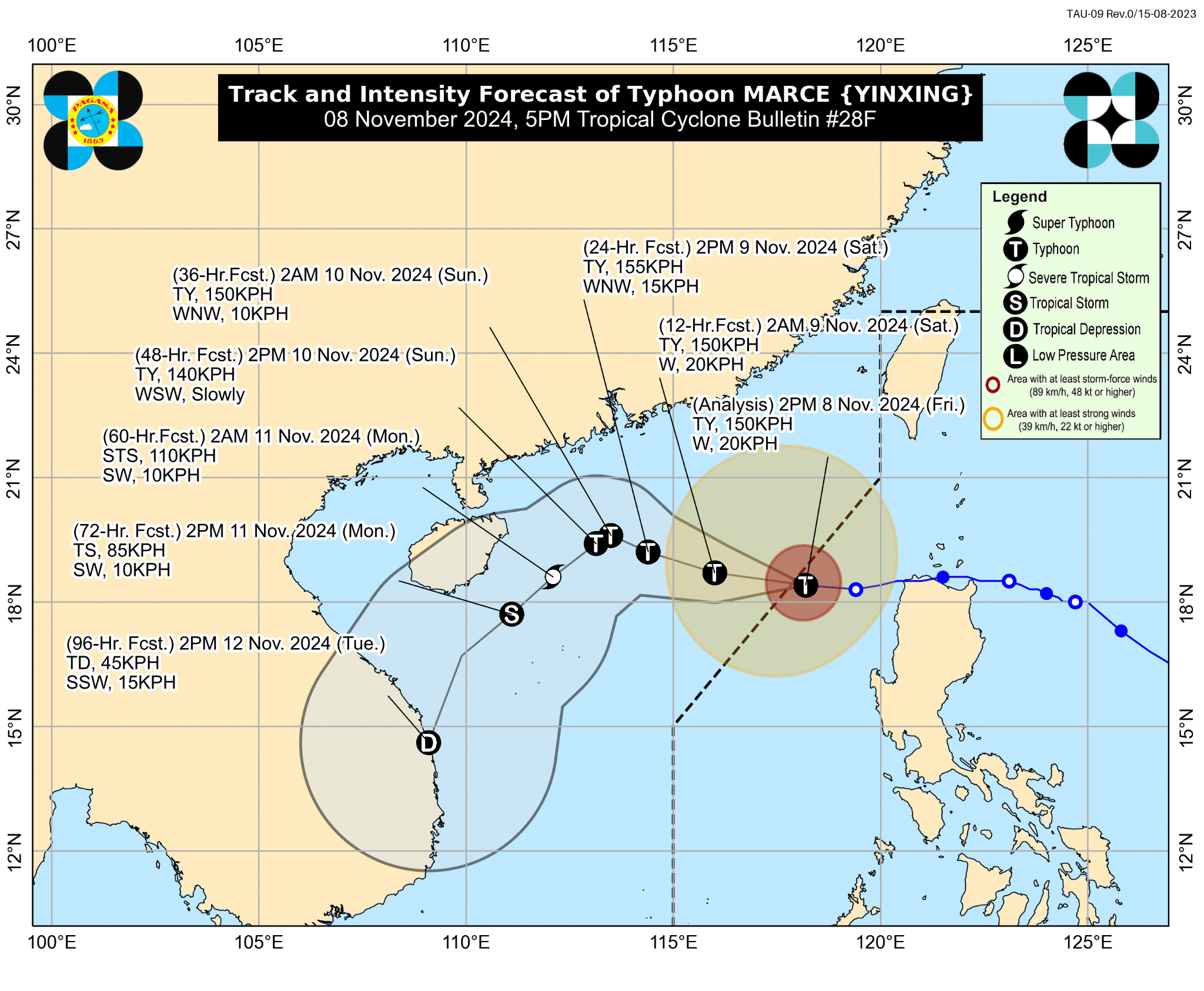
Marce exits PAR; trough to bring rains over Ilocos

Image from DOST / Pagasa
MANILA, Philippines — Typhoon Marce (International name: Yinxing) left the Philippine area of responsibility at 4 p.m. on Friday, Nov. 8, according to state meteorologists.
In its 5 p.m. bulletin, the Philippine Atmospheric, Geophysical and Astronomical Services Administration (Pagasa) said, “Tropical Cyclone Marce is now less likely to bring significant heavy rainfall over the country.”
“However, its trough will continue to bring scattered rains and thunderstorms over Ilocos Norte and Ilocos Sur in the next 24 hours,” it added.
READ: LIVE UPDATES: Typhoon Marce
Marce’s latest location was 290 kilometers west of Laoag City, Ilocos Norte.
Article continues after this advertisementREAD: Philippines cleans up after Typhoon Marce slams north coast
Article continues after this advertisementThe typhoon maintained maximum sustained winds of 150 kms per hour with a gustiness of up to 185 kph, moving 20 kph west-southwestward.
Pagasa lifted all Tropical Cyclone Wind Signals, but strong to gale-force winds are still expected in Batanes, northern Cagayan including the Babuyan Islands, and the Ilocos Region.
A gale warning remained hoisted over the western coast of Northern Luzon.
Moreover, the state weather bureau said there was no longer a threat of storm surge inundation.
Marce was forecasted to regain strength in the next 24 hours as it moves westward over the West Philippine Sea.
Afterwards, it is expected to weaken due to a surge of northeastern winds, Pagasa added.