Gov’t on ‘high alert’ for Marce impact

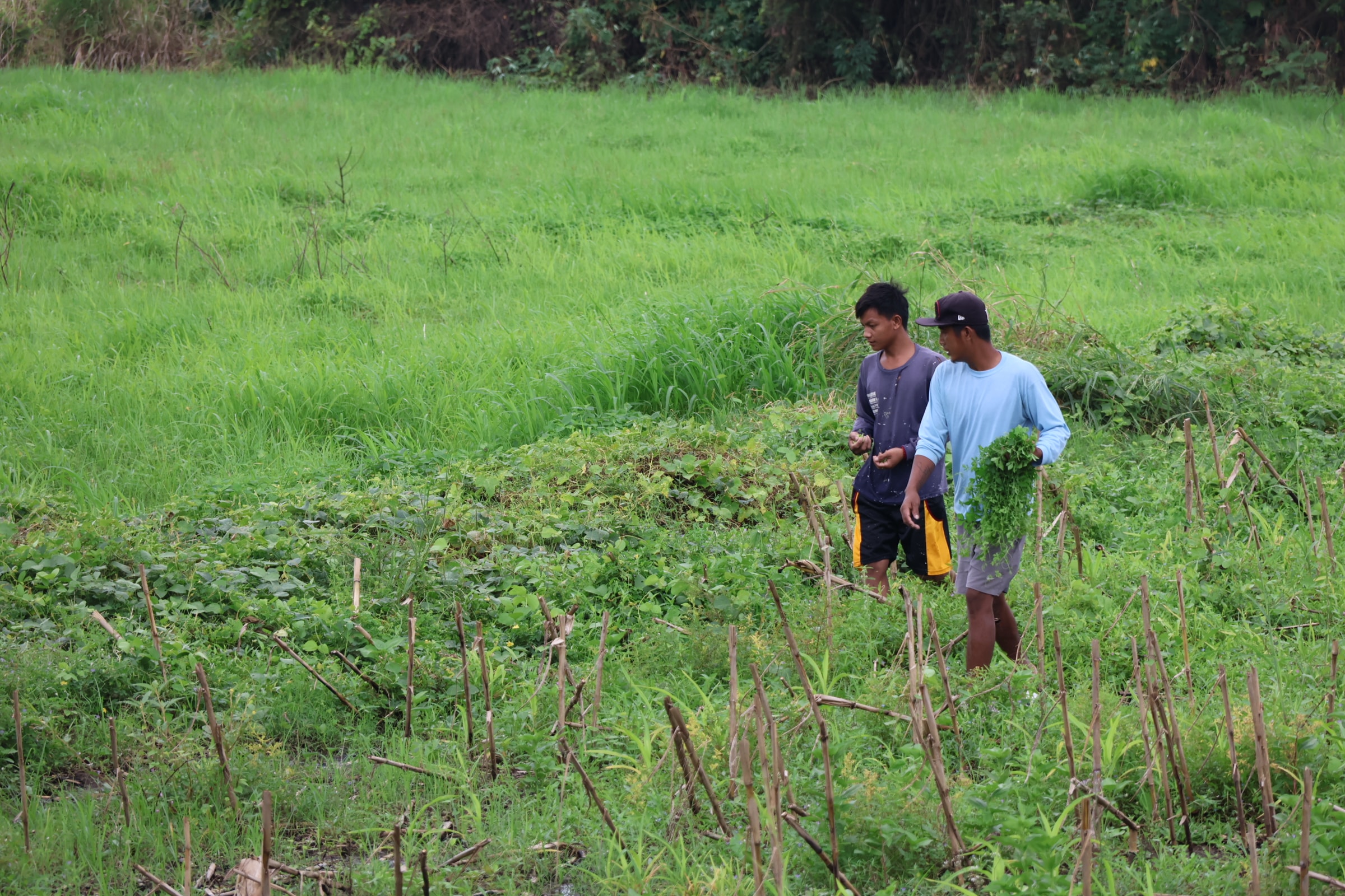
EARLY HARVEST With Typhoon Marce (international name: Yinxing) fast approaching, residents of Barangay Linglingay in Gamu, Isabela, harvest their vegetables on Wednesday, knowing it may be their last chance to save what they can before the storm hits. —Villamor Visaya Jr.
MANILA, Philippines — President Marcos on Wednesday directed all concerned government agencies to be on high alert in anticipation of the impact of Typhoon Marce (international name: Yinxing) as it approaches Luzon mainland.
In a statement, the President asked officials to keep citizens informed on the dangers brought by Marce and to maintain an efficient communication flow among different agencies.
“Let us face Typhoon Marce with sufficient preparedness, with our best efforts, and based on long-established protocols for these kinds of challenges,” he said.
READ: Typhoon Marce intensifies; Signal No. 3 in Cagayan town
“To the agencies of government: You know the drill, I am placing you on high alert,” he added, noting that conditions of rivers, lakes, coastal areas, and other waterways should be monitored round-the-clock.
Article continues after this advertisementMarcos issued the directive while visiting flood-hit communities in Camarines Sur and Albay in the Bicol region, just as the weather bureau raised storm warning signals in northern Luzon.
Article continues after this advertisementBy Thursday or Friday, the storm was forecast to make landfall or pass very close to the Babuyan Islands or the northern portions of mainland Cagayan, Ilocos Norte, and Apayao, the weather bureau said.
In its bulletin released at 5 p.m. on Wednesday, the Philippine Atmospheric, Geophysical and Astronomical Services Administration (Pagasa) said the center of Marce was located 295 kilometers east of Aparri, Cagayan, with maximum sustained winds of 150 km per hour near the center and gustiness of up to 185 kph.
The storm is slowly moving westward and is expected to accelerate as it crosses over the Babuyan Channel from Thursday to Saturday, and may exit the Philippine area of responsibility late Friday.
Tropical Cyclone Wind Signal No. 3 was raised over the northeastern portion of mainland Cagayan, while Signal No. 2 was raised over Batanes, the rest of Cagayan, including Babuyan Islands, the northern portion of Isabela, Apayao, the northern portion of Kalinga, the northern portion of Abra, Ilocos Norte and the northern portion of Ilocos Sur.
The rest of Ilocos Sur, La Union, the northwestern portion of Pangasinan, the rest of Abra, the rest of Kalinga, Mountain Province, Ifugao, Benguet, the rest of Isabela, Quirino, Nueva Vizcaya and the northern portion of Aurora were under Signal No. 1.
Evacuation
Chris Perez, Pagasa assistant weather services chief, said in a press briefing that the storm’s slow movement could result in more rains over affected areas.
For Thursday, intense to torrential rainfall is expected over Cagayan, Apayao, and Ilocos Norte, while heavy to intense rainfall will be experienced over Batanes, Abra, and Ilocos Sur.
In Cagayan Valley, the Regional Disaster Risk Reduction and Management Council has ordered preemptive evacuations in 268 barangays across Cagayan province, which are at high risk for landslides and flooding.
Leon Rafael, Office of Civil Defense regional director, had directed town and city mayors, along with local disaster response offices, to begin evacuating residents in high-risk areas identified as having “high to very high susceptibility” to rain-induced landslides and floods.
These villages are mostly in the towns of Rizal, Pamplona, Abulug, Baggao, Gattaran, Gonzaga, and Sta. Ana.
Bracing for ‘worst’
The provinces of Cagayan and Isabela are still reeling from the impact of Severe Tropical Storm Kristine (Trami) and Supertyphoon Leon (Kong-rey), which left a trail of destruction in a large part of northern Luzon last month.
Rafael said they were preparing for “the worst possible situation.”
Given the expected heavy rainfall, preparations are also focused on potential flooding near the Cagayan River, which could affect over 777,000 residents across 26 towns and cities in Cagayan and Isabela.
In Cagayan, classes from kindergarten to Grade 12 in public and private schools had been suspended in Tuguegarao City, Allacapan, Peñablanca, Solana, Santa Praxedes, Baggao, Sanchez Mira, Gonzaga and Sta. Teresita. Classes in all levels were also suspended in other towns like Amulung, Aparri, Alcala, Camalaniugan, Enrile, Lal-lo, Lasam, and Sta. Ana.
Marcos said he would leave the decisions to government experts on the need to release water from dams to mitigate flooding.
“Let us have all rescue equipment readied in all levels of government, all agencies who may be able to contribute their available resources, especially vehicles,” he said.
He also directed the Department of Public Works and Highways and the Department of Transportation to be on standby for imminent road-clearing operations.
Relief goods must also be “forward deployed” at safe storage locations that would allow their fast dispersal, the President said.
The Department of Social Welfare and Development on Wednesday said it has some 1.4 million boxes of food packs on standby for families in areas along the typhoon’s path.
Social Welfare Undersecretary Diana Rose Cajipe noted that “repacking stations” had been activated in Central Luzon to ensure that the inventory for food packs was intact. —with a report from Kathleen De Villa