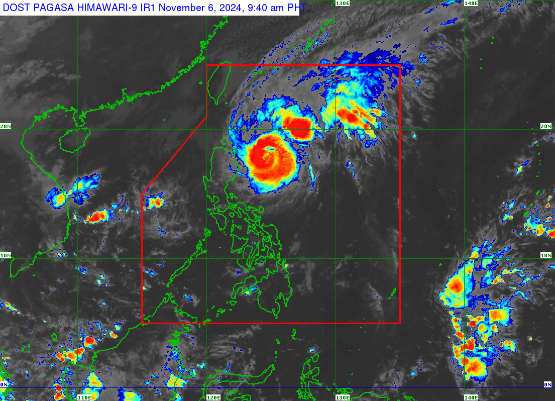
(Satellite photo of Typhoon Marce from Pagasa)
MANILA, Philippines — Typhoon Marce (international name: Yinxing) slowed down over the Philippine Sea as it moved westward on Wednesday, according to the Philippine Atmospheric, Geophysical and Astronomical Service Administration (Pagasa).
According to the state weather bureau’s 8 a.m. bulletin, Marce was last located some 335 kilometers east of Tuguegarao City, Cagayan.
It packs maximum sustained winds of 140 kilometers per hour (kph) near its center, with up to 170 kph gusts.
Heavy to intense rains, ranging from 100 to 200 millimeters (mm), may be experienced in Cagayan on Thursday.
Moderate to heavy rains of 50 to 100 mm may be expected in Batanes, Isabela, and Aurora.
“Under these conditions, flooding and rain-induced landslides are likely, especially in areas that are highly or very highly susceptible to these hazards as identified in hazard maps and in areas with significant antecedent rainfall,” Pagasa warned.
(Track of typhoon Marce from Pagasa)
Tropical Cyclone Wind Signal (TCWS) No. 2 remains hoisted in the following Luzon areas:
- eastern portion of Babuyan islands: Camiguin Island, Babuyan Island, Calayan Island, and Fuga Island
- the northeastern portion of mainland Cagayan: Santa Ana, Gonzaga, Lal-Lo, Santa Teresita, Buguey, Gattaran, Aparri, Camalaniugan
Wind speeds ranging from 62 to 88 kph may be expected within 36 hours in areas under TCWS No. 2, posing a minor to moderate threat to life and property.
Meanwhile, the following areas are placed under TCWS No. 1:
- Batanes
- rest of the Babuyan Islands
- rest of mainland Cagayan
- Ilocos Norte
- Ilocos Sur
- Apayao
- Abra
- Kalinga
- Mountain Province
- Ifugao
- northern portion of Benguet: Mankayan, Buguias, Kabayan, Bakun, Kibungan, Atok, Bokod
- Isabela
- Nueva Vizcaya
- Quirino
- northern portion of Aurora: Dilasag, Casiguran, Dinalungan, Dipaculao, Baler, Maria Aurora
Areas under TCWS No. 1 may expect winds of up to 39 to 61 kph within 36 hours, with minimal to minor threat to life and property.
Pagasa added that TCWS No. 4 is the highest wind signal that may be hoisted during the occurrence of Marce.
READ: Marce sustains strength over PH Sea; 2 areas under Signal No. 2
A gale warning was raised over the seaboards of Northern Luzon and the eastern seaboard of Central Luzon.