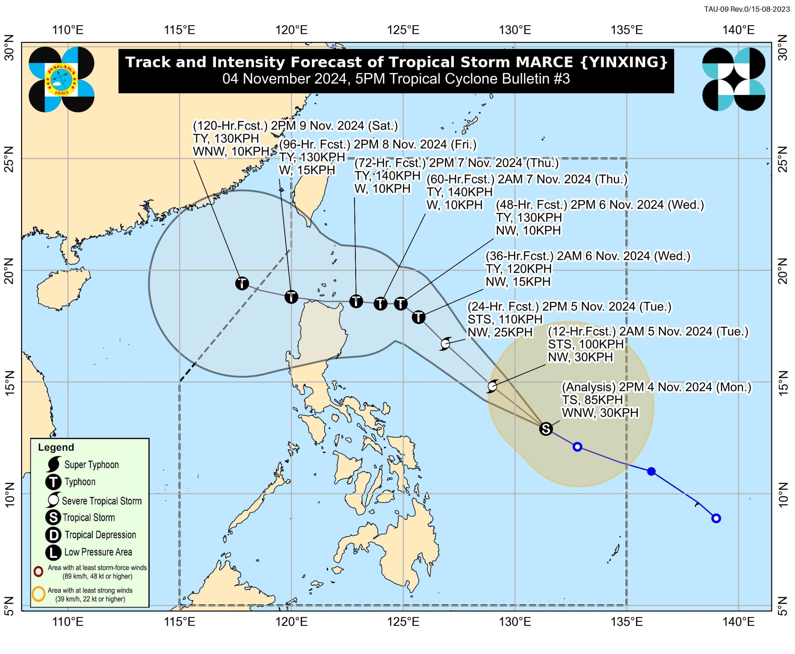
MANILA, Philippines — Signal No. 4, the highest possible wind signal, is forecast during the expected effects of Tropical Storm Marce (international name: Yinxing), which further intensified late Monday afternoon, the state weather bureau said.
According to the Philippine Atmospheric, Geophysical and Astronomical Services Administration (Pagasa) in its 5 p.m. bulletin, tropical cyclone wind Signal No. 1 may be hoisted over parts of Cagayan by Monday evening or Tuesday morning.
“The highest Wind Signal which may be hoisted during the occurrence of Marce is Wind Signal No. 4,” Pagasa said.
Marce is then expected to rapidly intensify in strength and reach the severe tropical storm category by Monday night or Tuesday morning.
It may then further reach the typhoon category by Tuesday evening or Wednesday early morning.
Marce was last spotted over the Philippine Sea coasting towards Northern Luzon at 740 kilometers (km) east of Virac, Catanduanes as of 4 p.m.
It currently carries maximum sustained winds of 85 km per hour (kph) and gustiness of up to 105 kph while moving west northwestward at 30 kph.
Meanwhile, Marce is also expected to strengthen the effects of the northeasterly wind flow which will bring strong to gale-force gusts on Monday over Batanes, Cagayan including Babuyan Islands, Isabela, Ilocos Norte, Aurora, and the northern portion of Quezon.
Based on its latest forecast track, Marce is still forecast to make landfall in the vicinity of Babuyan Islands or mainland northern Cagayan on Thursday evening or Friday early morning.
However, there is also a possibility that it will instead make landfall within the mainland Cagayan-Isabela area.

