Signal No. 2 up in parts of Batanes as Leon makes landfall in Taiwan

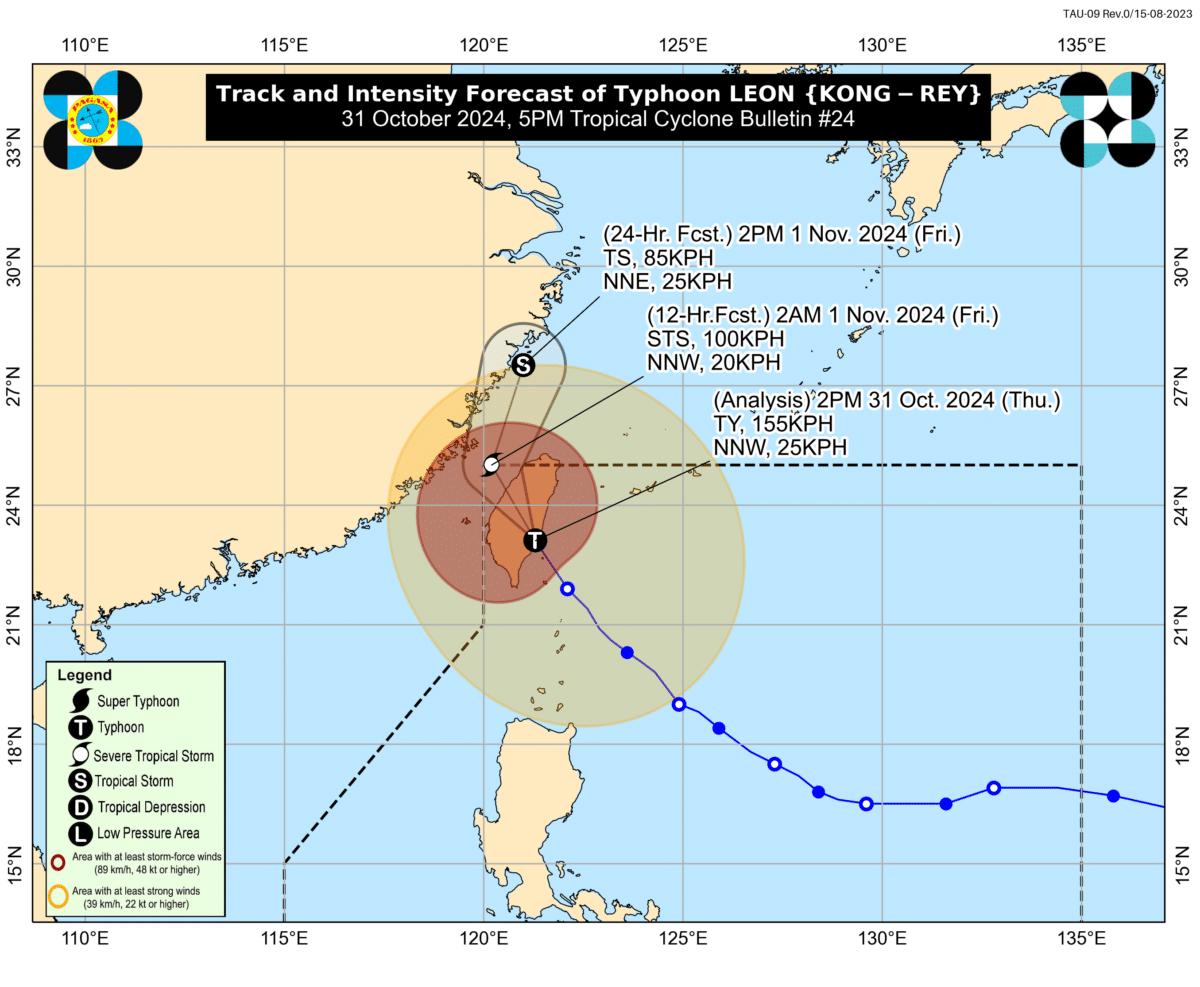
Typhoon Leon’s track. Image from Pagasa.
MANILA, Philippines — The Tropical Cyclone Wind Signal in parts of Batanes was downgraded to No. 2 as Typhoon Leon made landfall in Taiwan, the Philippine Atmospheric Geophysical Astronomical Services Administration (Pagasa) said on Thursday afternoon.
According to Pagasa’s 5 p.m. typhoon bulletin, Leon was last spotted 320 kilometers (km) North Northwest of Itbayat, Batanes or in the vicinity of Chiayi County, Taiwan as of 3 p.m.
It carried maximum sustained winds of 155 km per hour (kph) near the center and gustiness of up to 255 kph while moving northwestward at 25 kph.
Pagasa said Leon is expected to exit the Philippine Area of Responsibility (PAR) by Thursday night or Friday morning.
Article continues after this advertisement“Leon is forecast to further weaken throughout the forecast period due to land interaction and marginally favorable environmental conditions,” it added.
Article continues after this advertisementSignal No. 2 remains hoisted over northern Batanes.
Meanwhile, Signal No. 1 is raised over the following areas:
- rest of Batanes
- Babuyan Islands
- northern portion of mainland Cagayan (Santa Praxedes, Sanchez-Mira, Claveria, Pamplona, Abulug, Ballesteros, Aparri, Camalaniugan, Buguey, Gonzaga, Santa Teresita, Santa Ana)
- northern portion of Ilocos Norte (Bangui, Burgos, Dumalneg, Adams, Pagudpud)
Despite its distance, Leon is still forecast to bring gusty conditions in the following areas:
- Cordillera Administrative Region
- Quirino, Nueva Vizcaya
- Aurora
- Bataan
- Metro Manila
- Calabarzon
- Mimaropa
- Bicol Region
- Northern Samar
- Western Visayas
Pagasa also warned that there is still a “moderate risk of life-threatening storm surge” with peak heights of 2 to 3 meters above normal tide levels over the low-lying or exposed coastal localities of Batanes. The risk is expected to decrease as Leon moves further away from the country.
READ: LIVE UPDATES: Super Typhoon Leon