Wet, windy ‘Undas’ seen as Leon approaches

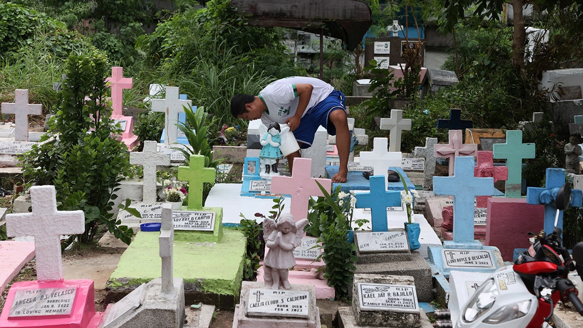
IN REMEMBRANCE The cleanup of cemeteries across the country, like here at the Manila South Cemetery in Makati on Tuesday, has begun for the observance of All Saints’ and All Souls’ Day this Friday and Saturday, respectively, which may turn out to be a rainy affair because of Typhoon Leon. —Marianne Bermudez
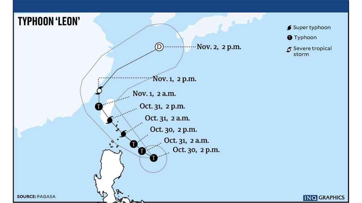
MANILA, Philippines — The observance of All Saints’ Day and All Souls’ Day is expected to be rainy and windy in much of Luzon as Typhoon Leon (international name: Kong-Rey) moves closer to the northern provinces in the next three days, the weather bureau said on Tuesday.
Marcelino Villafuerte II, deputy administrator for research and development of the Philippine Atmospheric, Geophysical and Astronomical Services Administration (Pagasa), noted that Leon was headed for areas still reeling from the impact of Typhoon Julian (Krathon) and Severe Tropical Storm Kristine (Trami).
READ: Leon may become super typhoon
“We are particularly calling on the residents of northern Luzon to take extra precaution in the coming days as they will experience strong winds and heavy rains because of the typhoon,” he said during the “Bagong Pilipinas Ngayon” government briefing.
Villafuerte issued the warning after Pagasa categorized Leon as a typhoon with sustained winds of 150 kilometers per hour near the center and gustiness of up to 185 kph.
Article continues after this advertisementBased on Pagasa’s 5 p.m. bulletin, the eye of the typhoon was located 505 km east of Tuguegarao City, Cagayan, or 515 km east of Aparri.
Article continues after this advertisementLeon is mostly affecting northern and eastern Luzon, but its trough or extension may reach parts of the Visayas, weather specialist Veronica Torres said.
Out by Friday
Moving west-northwestward at 10 km/h, Leon may make landfall or pass close to Batanes on Thursday before turning northward and leaving the Philippine area of responsibility by late Thursday or early Friday.
Leon may continue to intensify as it moves over the Philippine Sea and may become a supertyphoon when it nears Batanes.
Signal No. 2 was declared over Batanes, Babuyan Islands, mainland Cagayan, the northern and eastern portions of Isabela, Apayao, the northern portion of Kalinga, the northern portion of Abra, and Ilocos Norte.
Placed under Signal No. 1 were the rest of Isabela, Quirino, Nueva Vizcaya, the rest of Kalinga, Mountain Province, Ifugao, Benguet, the rest of Abra, Ilocos Sur, La Union, the eastern portion of Nueva Ecija, Aurora, the northern and eastern portion of Quezon including Polillo Islands, Camarines Norte, Camarines Sur, Catanduanes, Albay, and the northern portion of Sorsogon.
