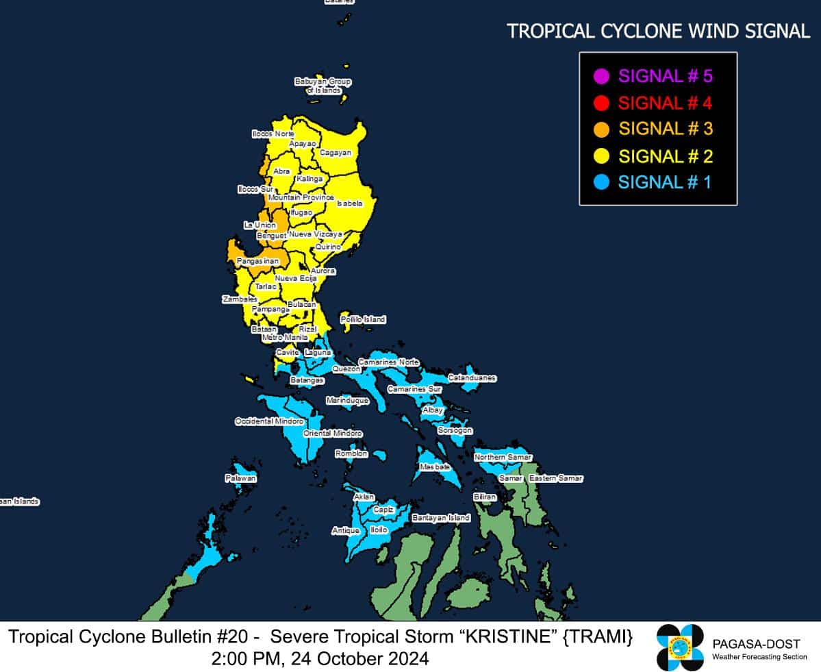
MANILA, Philippines — Severe Tropical Storm Kristine (international name: Trami) is now over the coastal waters of Santa Cruz in Ilocos Sur, the state weather bureau reported on Thursday afternoon.
In its 2 p.m. cyclone update, the Philippine Atmospheric, Geophysical and Astronomical Services Administration (Pagasa) said Kristine was moving west-southwestward at 15 kilometers per hour (kph).
It is carrying maximum sustained winds of 95 kph and gusts of up to 145 kph.
Kristine is forecast “to move westward or west-northwestward over the West Philippine Sea and exit the Philippine Area of Responsibility (PAR) region on Friday afternoon (25 October).
According to the latest report of the National Disaster Risk Reduction and Management Council, Kristine has so far affected over two million individuals nationwide.
Since Kristine maintained its strength, Pagasa said the following areas remain under wind signals:
Tropical Cyclone Wind Signals (TCWS) No. 3
- Benguet
- Ilocos Sur
- La Union
- Pangasinan
TCWS No. 2
- Metro Manila
- Batanes
- Cagayan including Babuyan Islands
- Isabela
- Quirino
- Nueva Vizcaya
- Apayao
- Kalinga
- Abra
- Ifugao
- Mountain Province
- Aurora
- Nueva Ecija
- Tarlac
- Zambales
- Bataan
- Pampanga
- Bulacan
- Rizal
- Cavite
- The western portion of Batangas (Nasugbu, Lian)
- The northern portion of Quezon (General Nakar, Infanta) including Polillo Islands
- Lubang Islands
TWCS No. 1
- Laguna
- The rest of Batangas
- The rest of Quezon
- The rest of Occidental Mindoro
- Oriental Mindoro
- Marinduque
- Romblon
- The northern portion of mainland Palawan (El Nido, Taytay, Araceli, San Vicente, Dumaran, Roxas) including Calamian Islands, Cuyo, and, Kalayaan Islands
- Camarines Norte
- Camarines Sur
- Catanduanes
- Albay
- Sorsogon
- Masbate including Ticao and Burias Islands
- Aklan
- Capiz
- Antique including Caluya Islands
- Iloilo
- Bantayan Islands
- Northern Samar
- The northern portion of Samar (Santa Margarita, Almagro, Tagapul-An, Calbayog City, Santo Nino, Gandara, Matuguinao)
