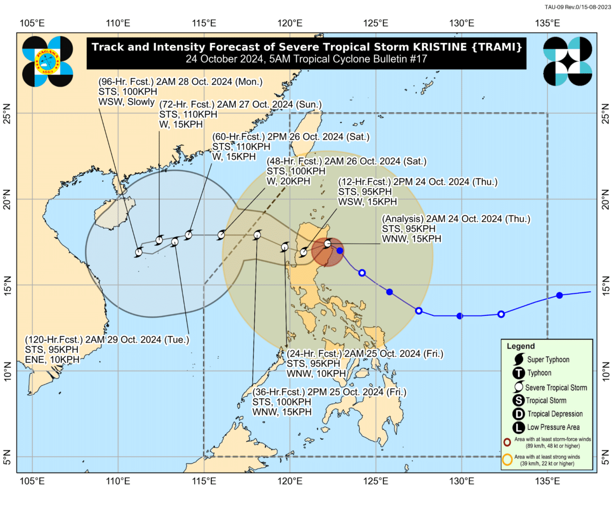
Kristine gradually slowing down while moving over Northern Luzon
READ: LIVE UPDATES: Tropical Storm Kristine
MANILA, Philippines – The state weather bureau in its 5 a.m. update on Thursday, October 24, said severe tropical storm Kristine (international name: Trami) was gradually slowing down as it crosses Northern Luzon.
The center of Kristine’s eye was located in the vicinity of Tumauini town in Isabela province, according to the Philippine Atmospheric, Geophysical and Astronomical Services Administration (Pagasa).
Kristine is still maintaining maximum sustained winds of 95 kilometers per hour while traveling 15 kph west of northwest.
READ: Kristine makes landfall; Intense rains expected in 9 provinces
Pagasa said in its track and intensity forecast that the tropical storm could decelerate to 10 kph by the time it reaches the vicinity of Bacnotan, La Union early Friday morning but regain speed when it crosses over to the West Philippine Sea.
In a separate weather advisory also on Thursday early morning. Pagasa added that more provinces in Luzon can expect intense to torrential rainfall on October 24. They are now the following:
- Pangasinan
- Zambales
- La Union
- Cagayan
- Isabella
- Nueva Vizcaya
- Quirino
- Apayao
- Mountain Province
- Kalinga
- Ifugao
- Aurora
Tropical Cyclone Wind Signal No. 3 is still up in 16 areas in Luzon.
State meteorologists also maintained a gale warning over the seaboards of Luzon and Visayas, as well as a storm surge warning over nine provinces along the storm’s path.
Pagasa said Kristine is still projected to emerge over waters west of Ilocos Region by either Thursday afternoon or evening and leave the Philippine area of responsibility by Friday afternoon.
