READ: LIVE UPDATES: Tropical Storm Kristine

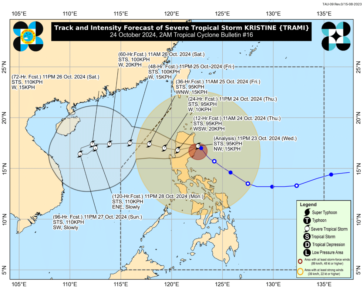
MANILA, Philippines – Severe Tropical Storm Kristine (international name: Trami) made landfall in Divilacan town in Isabela province at 12:30 a.m. on Thursday, October 24, the state weather bureau said.
Kristine had maximum sustained wind speeds of 95 kilometers per hour near the center and was moving northwestward at 15 km per hour, according to 2 a.m. bulletin of the Philippine Atmospheric, Geophysical and Astronomical Services Administration (Pagasa).
READ: Storm surge warning in 9 Luzon provinces
State meteorologists also said they expect intense to torrential rainfall on Thursday in the following:
- Cagayan
- Isabela
- Nueva Vizcaya
- Quirino
- Apayao
- Mountain Province
- Kalinga
- Ifugao
- Aurora
Meanwhile, the following areas are expected to have heavy to intense rainfall:
- The rest of Cagayan Valley
- The rest of the Cordillera Administrative Region
- Ilocos Region
- The rest of Central Luzon
- Metro Manila
- Calabarzon
- Occidental Mindoro
Moderate to heavy rainfall is expected in the following areas on Thursday:
- Oriental Mindoro
- Marinduque
- Romblon
- Calamian Islands
- Bicol Region
- Negros Occidental
- Western Visayas
Pagasa maintained that there was a moderate to high risk of life-threatening storm surge of up to 3 meters above normal tide levels in the next 48 hours in low-lying or exposed coastal localities in the following provinces:
- Ilocos Norte
- Ilocos Sur
- La Union
- Pangasinan
- Cagayan
- Isabela
- Aurora
- Zambales
- Quezon
Kristine is still forecasted to cross and slightly weaken over Northern Luzon and emerge over waters west of the Ilocos Region by Thursday afternoon, October 24.
The weather bureau said it expected the severe tropical storm to exit the Philippine area of responsibility on Friday afternoon, October 25.

