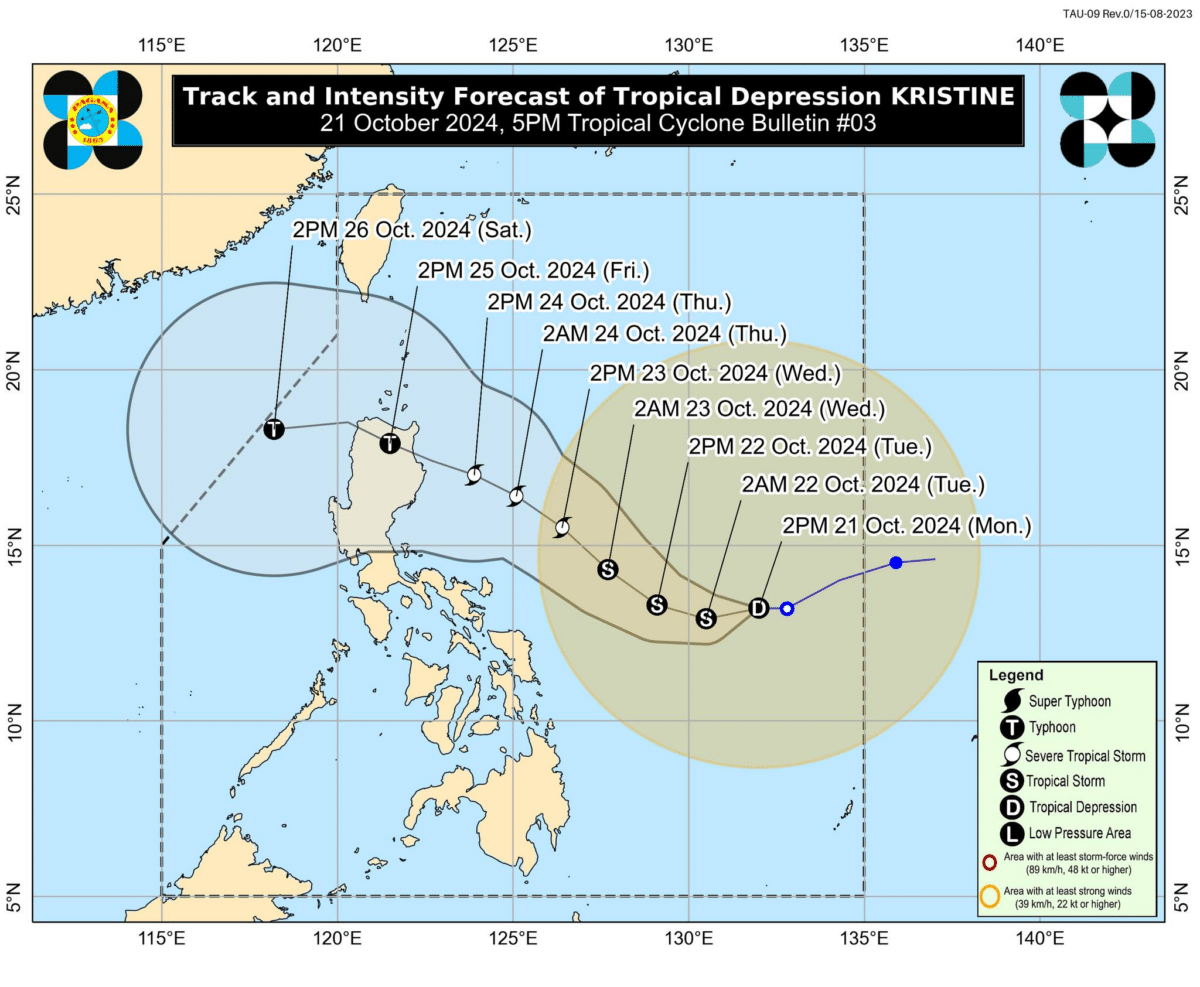
Track and Intensity Forecast of TD Kristine released as of October 21, 2024, 5 p.m. —Image from the Pagasa Facebook page
MANILA, Philippines — Tropical Depression (TD) Kristine has maintained it strength while moving west over the Philippine Sea, with Tropical Cyclone Wind Signal (TCWS) No. 1 up over several areas across the country on Monday afternoon, the Philippine Atmospheric, Geophysical and Astronomical Services Administration (Pagasa) said.
In its latest weather update, Pagasa said Kristine was last located some 760 kilometers east of Catarman, Northern Samar, still packing a maximum wind speed of 55 kilometers per hour (kph), gustiness of up to 70 kph, while moving west and slower at 15 kph, from 30 kph earlier.
A gale warning is up in the eastern seaboards of Southern Luzon and Visayas.
READ: EXPLAINER: What do color-coded rainfall warnings mean?
In its Monday afternoon weather bulletin, Pagasa said that TCWS No. 1 is still up over the following areas:
Luzon
- southeastern portion of Isabela: Palanan, Dinapigue
- Aurora
- northern and eastern portions of Quezon: Tagkawayan, Guinayangan, Buenavista, San Narciso, San Andres, General Nakar, Pitogo, San Francisco, Calauag, Pagbilao, Infanta, Lopez, Catanauan, Mulanay, Unisan, General Luna, Plaridel, Quezon, Alabat, Sampaloc, Padre Burgos, Macalelon, Mauban, Perez, Agdangan, Gumaca, Atimonan, Real
- Polillo Islands
- Camarines Norte
- Camarines Sur
- Catanduanes
- Albay
- Sorsogon
- Masbate including Ticao Island and Burias Island
Visayas
- Eastern Samar
- Northern Samar
- Samar
- Leyte
- Biliran
- Southern Leyte
Mindanao
- Dinagat Islands
- Surigao del Norte including Siargao-Bucas Grande Group


