Image from DOST / Pagasa
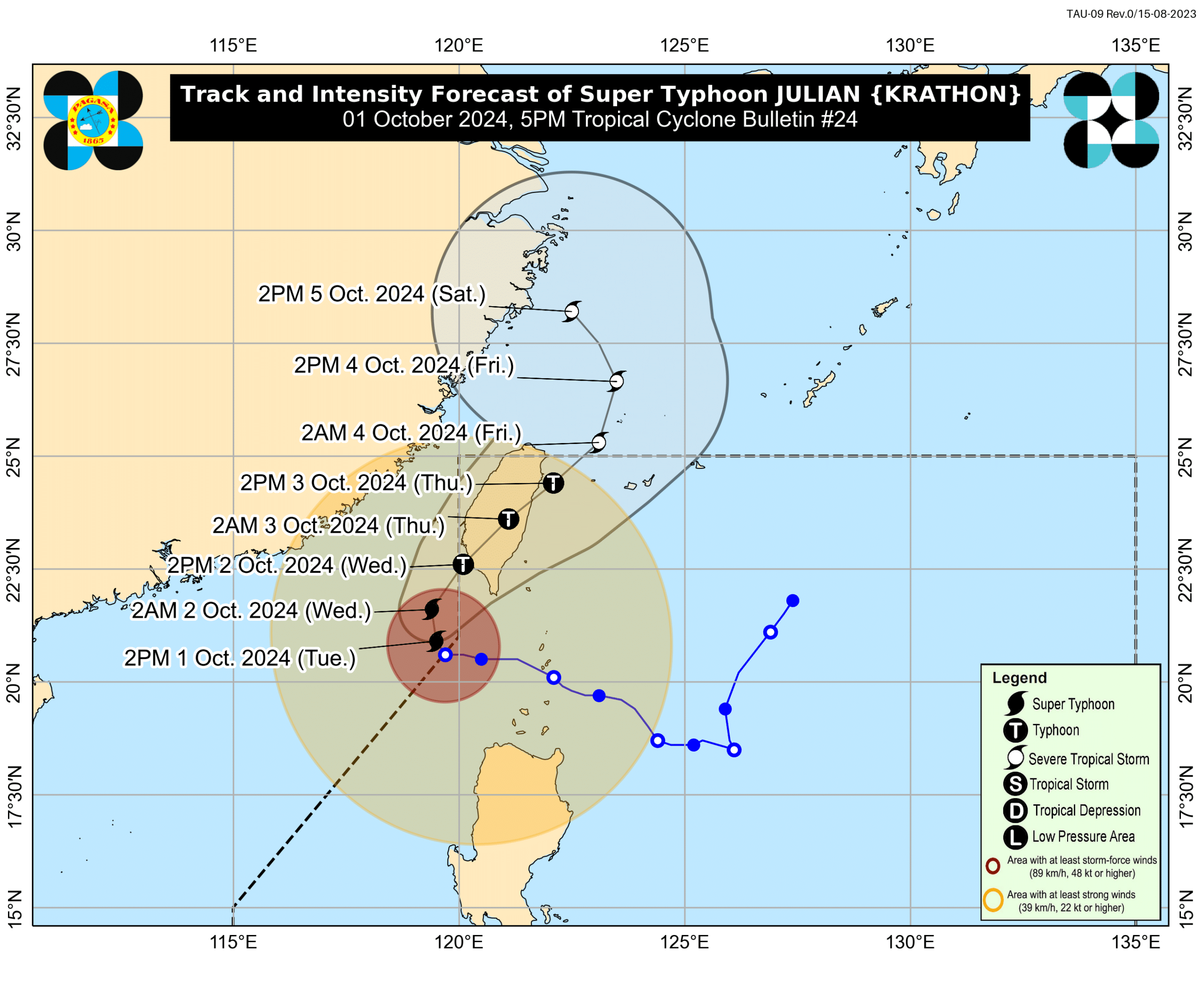
MANILA, Philippines — Northern Luzon areas are now placed under Tropical Cyclone Wind Signal (TCWS) No. 1 as super typhoon Julian starts to recurve north-northwestward, the state weather agency Philippine Atmospheric, Geophysical and Astronomical Services Administration (Pagasa) updated on Tuesday.
Based on its 5 p.m. bulletin, the following areas are now under TCWS No. 1:
- Ilocos Norte
- Ilocos Sur
- La Union
- Northern and western portions of Pangasinan (Lingayen, City of Alaminos, Anda, San Fabian, Mangaldan, Burgos, Dagupan City, Bolinao, Sual, Labrador, Bani, Pozorrubio, Mabini, Binmaley, San Jacinto, Bugallon, Infanta, Agno, Calasiao, Dasol, Sison)
- Apayao
- Abra
- Kalinga
- Mountain Province
- Ifugao
- Benguet
- Batanes
- Cagayan, including Babuyan Islands
- Northern and western portions of Isabela (Cabagan, Tumauini, Ilagan City, Santo Tomas, Delfin Albano, Alicia, San Mateo, Aurora, Quezon, Ramon, Naguilian, Roxas, Luna, City of Cauayan, Angadanan, City of Santiago, Reina Mercedes, San Manuel, Cabatuan, Quirino, Gamu, San Isidro, Mallig, Cordon, Burgos, Maconacon, San Pablo, Santa Maria, Benito Soliven)
- Northwestern portion of Nueva Vizcaya (Diadi, Bagabag, Quezon, Solano, Villaverde, Ambaguio, Bayombong, Bambang, Kayapa)
Pagasa advised intermittent rains may be expected in these areas within 36 hours.
READ: Julian intensifies outside PAR, may re-enter on Wednesday – Pagasa
Super typhoon Julian has maintained its strength with maximum sustained winds of 195 kilometers per hour (kph) and a gustiness of up to 240 kph.
However, it still has a window for brief intensification in the next 12 hours and may weaken slightly before making landfall as it passes through mountainous areas of Taiwan, the state weather bureau noted.

