


(Illustration from Pagasa)
MANILA, Philippines — Severe tropical storm Julian further intensified over the Philippine Sea on Sunday, according to the Philippine Atmospheric, Geophysical and Astronomical Services Administration (Pagasa).
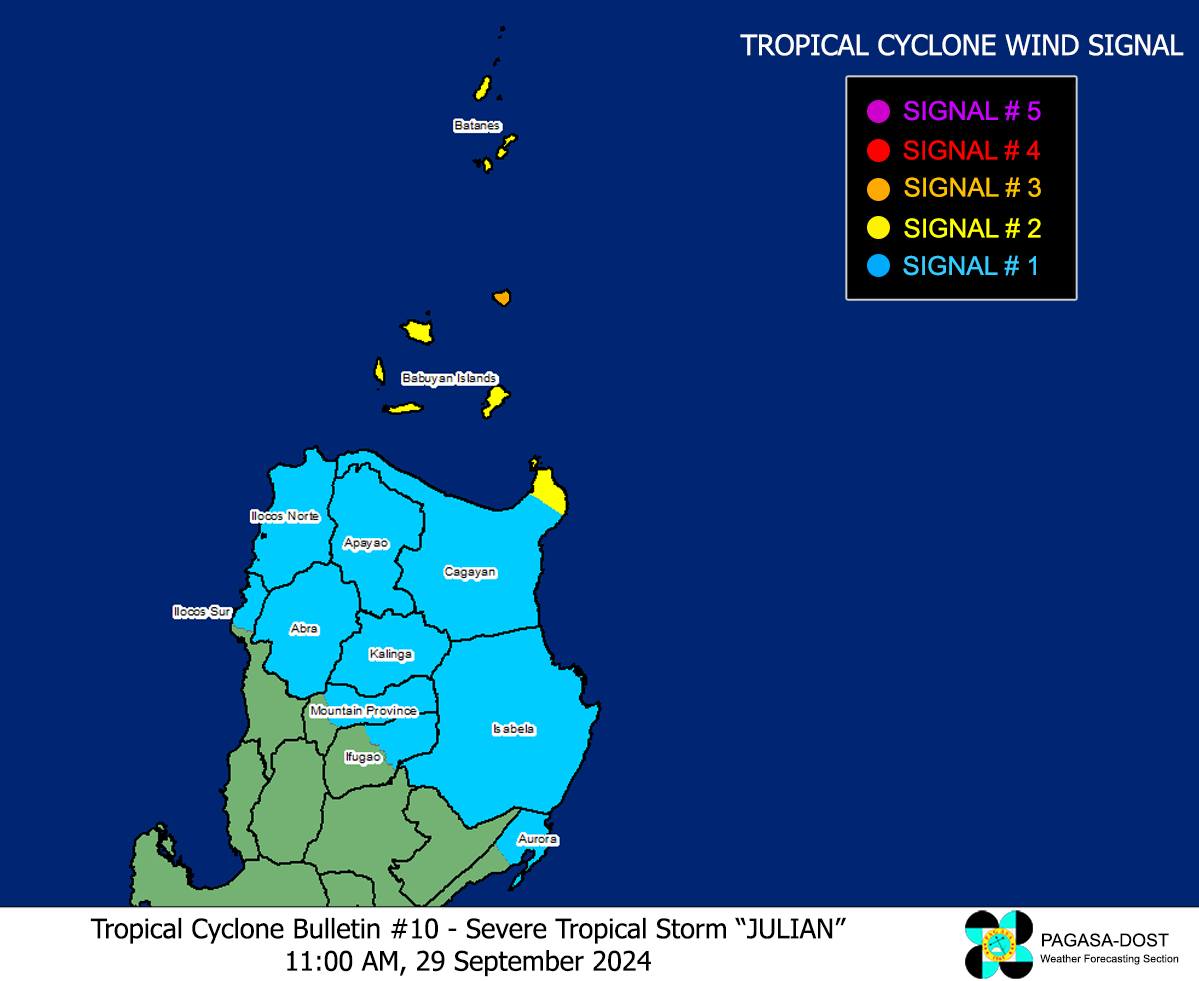
In its 11 a.m. cyclone update, the state weather service said Julian was last spotted some 290 kilometers (km) east northeast of Aparri in Cagayan or 300 km east of Calayan in Cagayan.
Pagasa said Julian was moving west-northwestward slowly, carrying maximum sustained winds of 110 kilometers per hour (kph) with gustiness of up to 135 kph.

Due to Julian’s intensification, Pagasa raised signal no. 3 in the northeastern portion of Babuyan Islands.
Meanwhile the following areas remain under wind signals:
Signal No. 2
Batanes
The northeastern portion of Mainland Cagayan (Santa Ana)
The rest of Babuyan Islands (Camiguin Island, Calayan Island, Dalupiri Island, Fuga Island)
Signal No. 3
The rest of Cagayan
Isabela
Apayao
Abra
Kalinga
Mountain Province
Ifugao
Ilocos Norte
Ilocos Sur
The northern portion of Benguet (Bakun, Mankayan, Buguias)
The northern portion of Aurora (Dilasag, Casiguran)
“On the track forecast, a landfall or close approach scenario by tomorrow (30 September) over Batanes and/or Babuyan Islands is highly likely,” Pagasa said.
“Julian will continue to intensify throughout the forecast period and reach typhoon category this evening. There is high chance of rapid intensification and the possibility of reaching super typhoon category is not ruled out,” it warned.