
Photo from Pagasa/Facebook
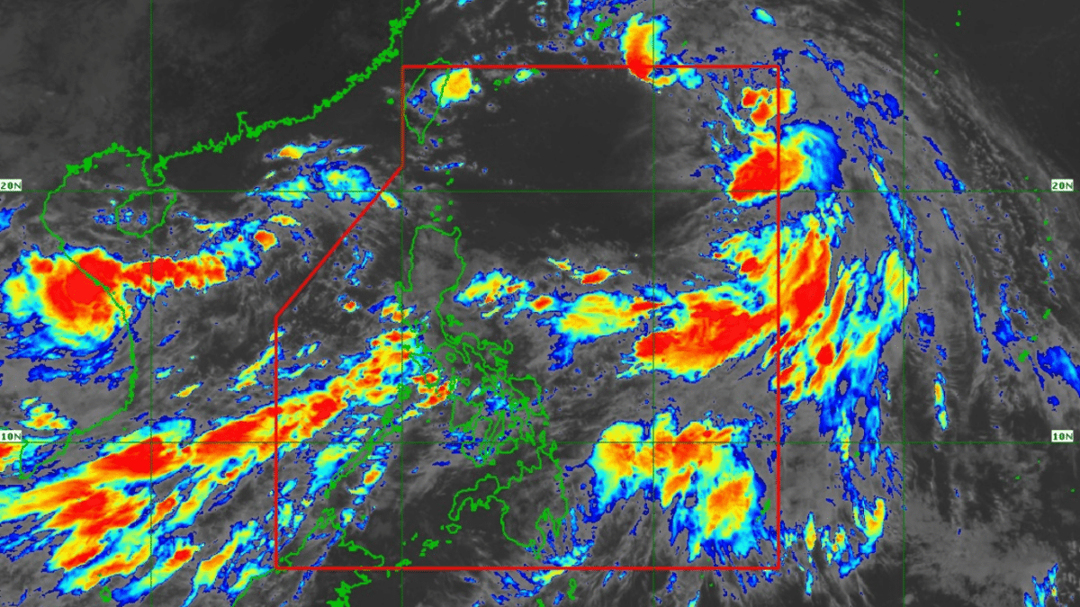
MANILA, Philippines — Tropical Storm Helen has enhanced the southwest monsoon, or habagat, as it moves over the Philippine Sea, the Philippine Atmospheric, Geophysical, and Astronomical Services Administration (Pagasa) said on Wednesday.
In its 11 a.m. weather bulletin, Pagasa said the following areas will experience strong to gale-force gusts brought by habagat enhanced by Helen and Tropical Depression Gener:
- Wednesday (September 18): Zambales, Bataan, Pampanga, Bulacan, Metro Manila, Calabarzon (Cavite, Laguna, Batangas, Rizal, Quezon), Mimaropa (Mindoro, Marinduque, Romblon, Palawan), Bicol Region, Visayas, Zamboanga Peninsula, Northern Mindanao, Caraga and Davao Region
- Thursday (September 19): Ilocos Region, Isabela, Aurora, Zambales, Bataan, Metro Manila, Calabarzon, Mimaropa, Bicol Region, Western Visayas, Negros Island Region, and Zamboanga Peninsula
- Friday (September 20): Ilocos Region, Isabela, Aurora, Zambales, Bataan, Cavite, Batangas, Quezon, Occidental Mindoro, Marinduque, and Romblon
The state weather bureau also advised that sea travel will be risky for small seacraft as gale warning is up in the western seaboard of Central Luzon, Southern Luzon, and Visayas.
“Helen is forecast to move northwestward for the entire forecast period and exit the PAR (Philippine Area of Responsibility) region this afternoon or evening. Throughout the forecast period, Helen will remain far from the Philippine landmass and will not directly affect any part of the country,” Pagasa said.
Helen was last located east northeast of the extreme Northern Luzon, packing up maximum sustained winds of 85 kilometers per hour (km/h) and gustiness of up to 105 km/h. It was moving northwestward with a speed of 25 km/h.
READ: Cloudy Wednesday with rain showers in parts of PH as Gener exits
Gener, meanwhile, exited the PAR at 2 a.m. on Wednesday.
READ: Walang Pasok: Class cancelations for September 18