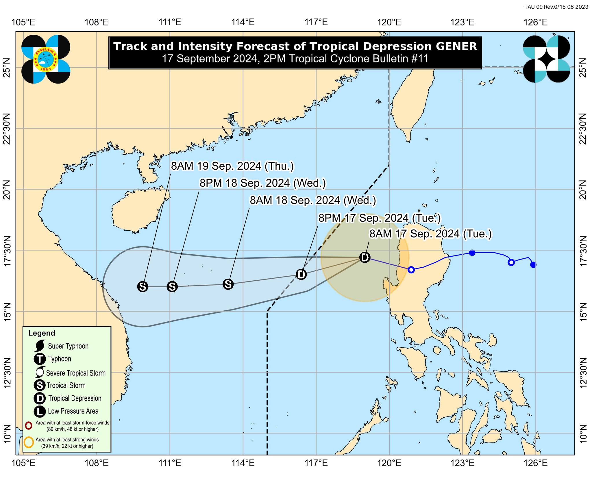
Image from DOST / Pagasa
MANILA, Philippines — Tropical Depression Gener slightly intensified as it reached the West Philippine Sea region on Tuesday afternoon, according to the state weather bureau.
Gener was last spotted about 255 kilometers west-northwest of Baguio City, based on the 2 p.m. cyclone update of the Philippine Atmospheric, Geophysical and Astronomical Services Administration (Pagasa).
Pagasa said the tropical depression is expected to exit the country’s area of responsibility by Tuesday night or Wednesday morning. It may also reach the tropical storm category by Wednesday morning.
READ: Gener maintains strength, habagat to drench parts of PH
Even after Gener left Luzon’s landmass, Pagasa said the following areas remain under Tropical Cyclone Wind Signal Number 1:
- The northwestern portion of mainland Cagayan (Pamplona, Santa Praxedes, Abulug, Sanchez-Mira, Claveria, Ballesteros)
- Babuyan Islands
- Apayao
- Abra
- Benguet
- Ilocos Norte
- Ilocos Sur
- La Union
- Pangasinan
Meanwhile, the state weather bureau lifted wind signals in the following areas:
- Isabela
- Quirino
- Nueva Vizcaya
- Kalinga
- Ifugao
- Mountain Province
- Zambales
- Tarlac
- Nueva Ecija
- Pampanga
Gener also enhanced the southwest monsoon or habagat, which continues to bring strong winds in Batanes, Mimaropa, Bicol Region, Visayas, and Mindanao.
A gale warning is still hoisted in the following areas:
- Batanes
- Cagayan including Babuyan Is.
- Ilocos Norte
- Occidental Mindoro
- Palawan
- Aklan
- Antique
- Iloilo
- Negros Occidental
- Negros Oriental
- Siquijor
- Cebu Bohol
- Southern Leyte Dinagat Islands
- Surigao del Norte
- Camiguin
- Zamboanga del Norte